Arlington Outdoor Lab, Fauquier County
Arlington Outdoor Lab, Fauquier County

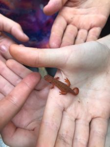
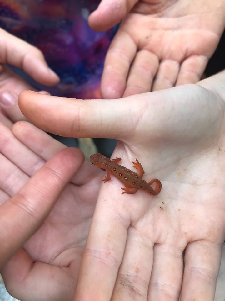
A red eft, the juvenile of the eastern newt, one of twenty documented species of amphibians found on the property.

Earlier this year, the future of the Arlington Outdoor Lab looked grim. The 225-acre outdoor education center serving Arlington Public Schools (APS) was about to be shut down because of proposed budget cuts.

For the first time in decades, money for teachers’ salaries, buses, and development of the outdoor STEM curriculum was not included in the APS draft budget.

Public outcry was immediate. County parents, students, and teachers made their voices heard through social media campaigns and letters to the school board. Former and current students crowded school board meetings, where many testified to the importance of the Lab to the innovative, hands-on STEM education that makes an APS education unique.

The public won. The district restored Lab funding for the coming fiscal year.

The Arlington community’s efforts to save the Lab are no surprise, since it had already rallied together to bring the Lab into existence in the first place.

It all started in the 1960s with Phoebe Hall Knipling, the science supervisor of Arlington Public Schools. Ahead of her time, Knipling championed hands-on science learning and wanted to develop a curriculum in which teachers took their science classes outside. But Arlington’s expanding residential development had made such a curriculum logistically impossible, as least within the county.

In 1967 Knipling heard of a 225-acre tract in Fauquier County whose owner needed to sell and was determined to see the land preserved in its natural state. Teaming up with local parents and teachers, Knipling created the Arlington Outdoor Education Association (AOEA), which raised money toward the purchase. To ensure protection of the property’s natural values, the AOEA donated an easement to the Virginia Outdoors Foundation in 1979 on 194 of its 225 acres, then purchased and added another 5 acres to the conserved tract in 1982.

Today, the Lab is an integral part of Arlington Public School’s STEM curriculum, hosting more than 10,000 elementary, middle and high school students every year. Students boat, fish, hike and camp while learning about nature first hand.

“I don’t know of any other school system that has these resources,” says Michele Karnbach, director of the Lab. “We’re in a valley between two small mountains, and a stream runs through it. We have a pristine pond, and amazing rock outcrops and overlooks.”

The repeated visits mean students form a connection to the property, and the longevity of the program means that parents who camped at the Lab in elementary school experience it again through their own children’s eyes. “We even have the grandchildren of former students out here now,” Karnbach says.

Connecting young people with natural spaces is also a way to raise future conservationists, she states. “Our goal is to give them that connection so that they then understand the value of the natural world. What they value, they then go on to protect. “

The funding crisis is a case in point: Arlington County parents and community members, the same ones who visited the Lab repeatedly during their own grade school careers, have become the site’s biggest advocates.
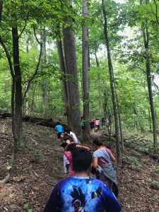
The Lab hosts over 10,000 students from the Arlington County public school district per year on day trips and overnights.

Immediate crisis averted, the AEOA is now looking forward, Karnbach states. “Our first goal is to increase capacity. We want to accommodate larger overnights and we want to have more kids during the day.”

As Arlington County continues to grow, making sure every district student has an opportunity to forge that connection with the land is more urgent than ever.

“We want to give every kid a sense of stewardship of this place,” Karnbach states. “That’s the way we ensure it doesn’t disappear.”

For information about the Lab’s grade school curriculum, Lab open houses for the community, and how to support the Lab in the future, go to the Arlington Outdoor Lab website. 
Wingate “Winkie” Mackay-Smith, Clarke County

Winkie Mackay-Smith believes land conservationists should never rely on just one program to achieve their goals, or as she puts it, “You need a belt with your suspenders.”

She saw it early on as a 40-year advocate in her home of Clarke County. “At the county level, you have a board of supervisors that determines the zoning. That means you’re only one county election cycle away from possibly losing a low-density or rural designation. You have to lock it in at the state and federal levels, too.”

Mackay-Smith has shored up support for land conservation by serving on the board of the Piedmont Environmental Council (PEC), the Clarke County Planning Commission, and the Clarke County Board of Zoning Appeals.

Her experiences with PEC and with the county led her to help found the Clarke County Easement Authority (CEA) in 2002. According to the Virginia Department of Conservation and Recreation website, Clarke County is one of 22 Virginia counties that protect open space in perpetuity by acquiring easements on private land. The Clarke County CEA has been one of the most successful, leveraging county-level agreements with federal and state grants (including the VOF-administered Preservation Trust Fund). This money comes with further legal defenses, so that the CEA’s “belt and suspenders” approach has permanently protected 8,019 acres of the county with 135 easements so far.

Add to that the lands in Clarke that are protected with easements held by VOF and other entities, and a total of 24 percent of the county’s land mass is permanently protected. Only nearby Fauquier County’s percentage is higher.

Mackay-Smith’s vision was key to the CEA’s success. “She saw that there was an opportunity for the county to have a slightly different role than larger land conservation entities,” says Alison Teetor, Clarke County’s natural resource manager, who staffs the CEA and works with various partner agencies to protect ground and surface water in the county. “The county is able to take smaller parcels and specify different criteria for conserved land so that more landowners can participate.”

Mackay-Smith’s own family’s land is protected under easement as well. “You can’t preach all that if you don’t do it yourself,” she says. Her home is on Greenwood Farm, one of several properties totaling more than 2,100 acres the Mackay-Smith family has placed under easement with VOF starting in the late 1970s.

Although she retired in 2014, Mackay-Smith is still active in the county’s land conservation efforts, says Teetor. “She still encourages landowners with a very direct but appropriate approach. I feel fortunate to have her on our team.”

As her work continues, Mackay-Smith’s forward-looking conservation vision goes beyond the single parcel of saved land. “It’s not my property or your property, it’s how everything fits together,” she says. “It’s the entire biome.”

Madison High School students contribute to Preserve stream restoration efforts through native tree plantings

Madison High School students contribute to Preserve stream restoration efforts through native tree plantings
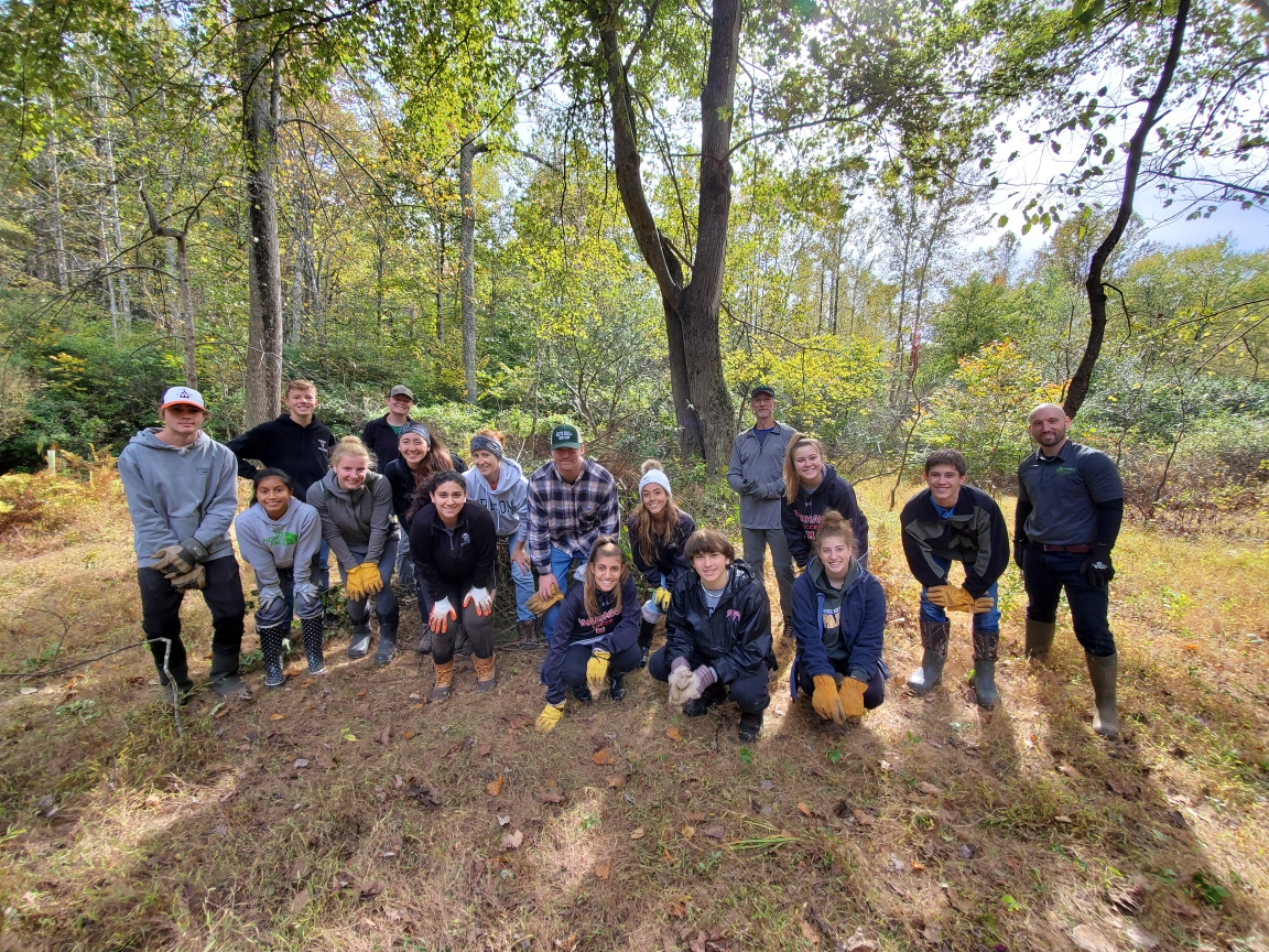
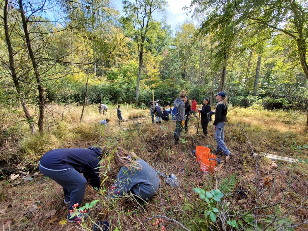
Madison High School students pose with VOF staff after a day of planting native black willow trees and clearing invasives in the Jackson Hollow section of the Preserve.

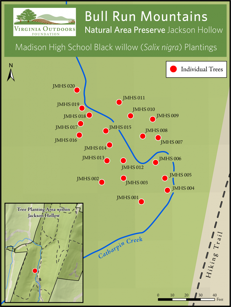
Madison High School students and staff dedicated the morning of October 19th to join VOF staff in continued stream restoration efforts in our Jackson Hollow section of the Bull Run Mountains Natural Area Preserve. Students planted 20 black willow (Salix nigra) trees along Catharpin Creek and removed invasive species taking up valuable real estate along the creek banks.

This portion of our ongoing stream restoration effort was supported through grant funding obtained by Madison High School biology teacher Dick Gongaware. The grant money was used to purchase the 20 trees and all tools and equipment needed for the project.

Black willow trees are beneficial for the Catharpin Creek ecosystem for a number of reasons. They provide textured shade cover and are excellent soil binders. The shade provided by these trees and close proximity to the creek is intended to create a shaded, cooler environment to keep water temperature lower throughout the year within the creek, which is ideal for brook trout habitat. The fibrous roots of the tree prevent soils from being washed away, stabilizing the stream banks.

Madison High School students contribute to Preserve stream restoration efforts through native tree plantings
Madison High School students at work planting black willows along Catharpin Creek
Madison High School students contribute to Preserve stream restoration efforts through native tree plantings
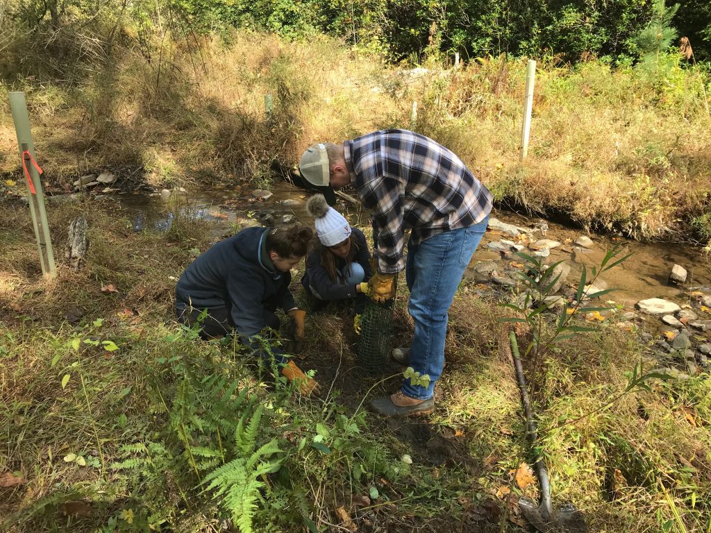
Students install a tree tube around one of the willow saplings. These tubes protect these small trees from browsing by herbivores.

 Stream restoration efforts in Jackson Hollow are all geared toward creating a more hospitable stream environment for our native brook trout population. Regular brook trout reintroductions occur in Catharpin Creek as part of VOF’s partnership with Dr. Kirk Smith, many dedicated high school students, the Virginia Department of Game and Inland Fisheries, and Trout Unlimited’s Trout in the Classroom program. Our hope through these reintroductions and stream restoration projects is to establish a thriving population of brook trout in Catharpin Creek, providing a study site and model reintroduction and restoration site for similar areas.

We have more work to do with this funding and are planning a phase-two stream restoration project. Stay tuned for more information on our continued work.

To see footage of our workday, check out this short video shot and produced by a local college student, Alden Grayson-Funk. We think he did a top notch job – so please check it out!

VOF Stream Restoration short film

Madison High School students contribute to Preserve stream restoration efforts through native tree plantings
Map depicting each planted willow location along the banks of Catharpin Creek.

Preserve staff presents research at the 2019 Natural Areas Association Conference, Pittsburgh, PA

VOF Preserve Manager, Joe Villari, and Preserve Technician, Summers Cleary, attended the 2019 Natural Areas Conference (NAC) held in Pittsburgh, PA in the second week of October. This year’s national conference focused on “At the Water’s Edge: Managing our Land and Water in a Changing Landscape”.

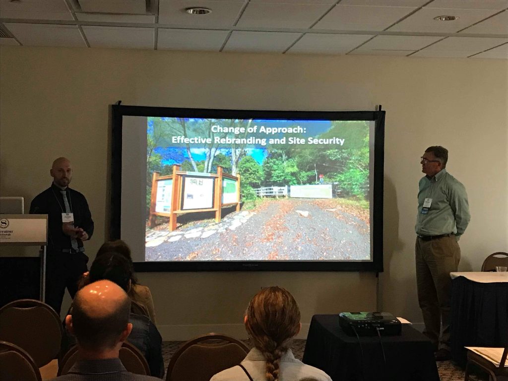
Joe Villari co-presented with Department of Conservation and Recreation Stewardship Manager, Michael Lott, on the management and restoration work being completed in areas throughout the Preserve. Their talk focused on ecological and public use access management strategies employed at the Preserve to protect sensitive ecosystems. These ecosystems are the very foundation of why the Preserve has been given the highest level of protection in the state of Virginia. Opportunities, like presenting at the NAC, enable staff to share our work with a much wider, larger scale audience and receive critical feedback on methods and approaches from other industry professionals.

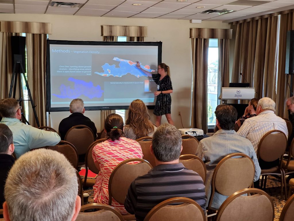
Summers Cleary presented her graduate school research project studying the breeding distribution and ecological influences of Worm-eating warbler (Helmitheros vermivorum) breeding site selection in VOF’s sister Preserve, Crow’s Nest Natural Area Preserve. This talk described her approach to modeling the breeding habitat of the Worm-eating warbler using several different environmental factors, and how these factors can predict further suitable breeding habitat. This study presents a methodology for combining Geographic Information Systems (GIS) and Species Distribution Modeling (SDM) to study the breeding habitat of a species and determining those environmental factors or conditions that are most influential when choosing breeding sites. 

Preserve staff presents research at the 2019 Natural Areas Association Conference, Pittsburgh, PA
Joe Villari (left), VOF, and Mike Lott (right), DCR-DNH, discuss methods of public use access management in regards to protecting sensitive ecosystems at the Preserve
Preserve staff presents research at the 2019 Natural Areas Association Conference, Pittsburgh, PA
Summers Cleary, VOF, displays results of isolating layers of vegetation density using LiDAR data throughout the vertical forest structure, used as an environmental variable in her model

Along with presenting their research, staff attended a myriad of talks and workshops. One such workshop was titled “Dendrochronology: Understanding Long-term Forest Change with Tree Rings” taught by Dr. Joe Marschall and Dr. Michael Stambaugh of University of Missouri. Dendrochronology is the scientific method of dating events (climatic or environmental change, history of fire, and geographically relative archaeological artifacts) by studying the patterns of growth seen in tree rings over time. This course provided an introduction to the science of dendrochronology focusing primarily on forest change and fire history of a landscape. The class covered field sample collection and laboratory analysis techniques, as well as methods of crossdating.

While the course used examples of studying the history of fire and fire as a management tool across red-pine and pitch pine ecosystems in Pennsylvania, it still held strong contextual information for the Preserve. Dendrochronology could potentially be used at the Preserve to help date some of our cultural sites and study environmental events throughout our landscape.

The ability to attend and participate in a conference such as the NAC, exposes staff to new methods, research, and management perspectives that can bolster current and future initiatives at the Preserve.

New River Hill Farm Education Center, Grayson County

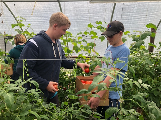
The hands-on learning the center provides gets kids excited about learning to grow their own food.

Getting kids to eat vegetables is never easy, but the New River Hill Farm Education Center has a secret recipe.

“You’d be surprised how many kids like the taste of radishes after they’ve grown them from seed,” says Tracy Goodson, district manager of the New River Soil and Water Conservation District, which runs Farm Days in collaboration with Grayson County Public Schools at the center.

At Farm Days, as many as 900 K-12 students a year get the satisfaction of planting and harvesting radishes, squash, tomatoes, cucumbers, peppers, and corn on the 131-acre property, which has been protected by the Virginia Outdoors Foundation since 2003, when owner Otis Philen donated an easement on it.

Opportunities to care for chickens and cows or grow trees with the Virginia Department of Forestry (DOF) are also part of the programs offered at the center.

One DOF activity this year included growing Allegheny chinkapin seedlings in the farm’s greenhouse. The Virginia native tree is in decline, and Goodson says that if the seedlings are successful DOF plans to replant them around the state.

“A day at the farm is more than a field trip,” says Goodson. “It’s hands-on learning where students can apply what they’ve talked about in the classroom. Teachers tell us that some of the kids aren’t engaged at all in the classroom, but when they come to us they get excited about what they are learning.”

Goodson defines the center’s success by the students it serves. “There was one student who didn’t seem interested at all in the beginning,” she says. “But over the course of the class he got more and more enthusiastic. By the end, he was talking to the agriculture teacher about different career opportunities within the agricultural community, like working as an agent at an extension office.”

The center has been able to reach even more students through a 2016 grant from the National Association of Conservation Districts for its “Learn to Grow” project. Thanks to the grant, the center was able to hire interns to help with 23 farm visits, scheduled over 18 months, from two area schools.

“Even though this is a rural area of the state, parts of it qualify as a food desert, so fresh produce is hard to find,” Goodson says. The USDA defines a food desert as a community of at least 500 people that is located more than one mile from the nearest supermarket or large grocery store. “We wanted to show young people how much food you could grow in a small space, so they could start growing their own produce.” Students left with some seed packets and the know-how to start their own gardens.

“For a lot of young people, gardening is a lost art,” Goodson says. “We want to help them rediscover it.”

VOF announces $3.9 million for forest conservation in five counties

VOF announces $3.9 million for forest conservation in five counties
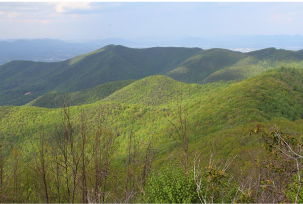
Landscape view of Poor Mountain near the southwest end of the preserve.

The Virginia Outdoors Foundation (VOF) has awarded $3,927,054 in grants to support six on-the-ground projects that protect and restore forests in Bland, Roanoke, Botetourt, Rockbridge, and Charlotte counties. Several of the projects will also create new opportunities for outdoor recreation and education in their communities.

These grants were awarded from the Forest CORE (Community Opportunities for Restoration and Enhancement) Fund — a component of VOF’s TERRA program, which administers funds resulting from legal and regulatory actions involving Virginia’s natural resources. The Forest CORE Fund was established with $15 million received by the Commonwealth of Virginia to mitigate for forest fragmentation caused by the Mountain Valley Pipeline.

Forest fragmentation occurs when large, contiguous forests are broken into smaller forests separated by roads, utility corridors, housing, and other development. Fragmentation can weaken forest health resiliency, degrade habitat, interfere with the movement and reproduction of animals, and increase invasive plants and other pests, resulting in loss of biodiversity.

This is the second round of Forest CORE grants to be announced. VOF awarded $3.6 million to seven other projects in December 2018. The expenditure of the funds is tied to the tree-clearing and grubbing activity of pipeline developers. Approximately 70 percent of the pipeline right-of-way in Virginia has been cleared and grubbed to date.

VOF developed the Forest CORE grant criteria in consultation with local officials, planning districts, conservation partners, and state agencies to ensure that community needs would be well represented.

The projects that have been approved for funding are:

Chestnut Ridge-Phase Two, Bland County, $999,500

The Virginia Department of Conservation and Recreation proposes to acquire 770 acres of forest in one of the highest-rated and least-protected ecological cores in the region. The proposed acreage buffers a documented stand of old-growth forest that is partially protected on an existing state natural area preserve. If acquired, the acreage would be managed for the long-term benefit of this forest community, including American chestnut and butternut — species that have been widely decimated throughout the region.

Poor Mountain-Phase Two, Roanoke County, $452,500

The Virginia Department of Conservation and Recreation proposes to acquire 100 acres adjacent to Poor Mountain Natural Area Preserve. The two properties support mature pine-oak heath forests and the globally rare pirate bush. This acquisition will reduce opportunities for fragmentation and greatly narrow the gap between disjunct parts of the preserve and other conserved lands nearby. The properties also contribute to scenic viewsheds for Salem and Roanoke.

Doc’s Way, Botetourt County, $700,000

The Appalachian Trail Conservancy (ATC) proposes to acquire 236.5 acres of high-quality forest in the viewshed of McAfee Knob, which is one of the most photographed vistas on the Appalachian National Scenic Trail. The parcel is currently under contract by ATC, with an agreement secured by funds raised by local citizen donations. The parcel has very high development potential. The property will be ultimately transferred to the National Park Service.

House Mountain, Rockbridge County, $155,000

The Virginia Outdoors Foundation proposes to acquire two parcels totaling 108 acres to be added to the existing 878-acre House Mountain Reserve. Deed restrictions to be held by the Virginia Department of Game and Inland Fisheries will codify existing VOF policies that make the land available for passive public recreation and permanently protect the forests. The property is regularly used for recreation and education by students from Washington and Lee University and the Virginia Military Institute, as well as groups of Scouts.

Read Mountain North, Roanoke County, $620,054

Roanoke County proposes to add 304 acres of forestland to the existing Read Mountain Preserve. The preserve has five miles of hiking trails. The main destination, Buzzards Rock, is located on the property proposed for acquisition and has been accessible to the public only by permission from the landowner. The new acquisition would make Buzzards Rock permanently accessible to the public, add trails to the preserve, prevent future development, and expand opportunities for hiking, biking, fishing and bird-watching.

Stanley Land and Lumber, Charlotte County, $1,000,000

Located at the confluence of Roanoke and Wards Ford Creeks, the Stanley Land and Lumber project will protect 4,944 acres in Charlotte County, 750 acres of which would be covered by Forest CORE funds. The Conservation Fund and Virginia Department of Forestry are acquiring this property to create a new state forest. The property contains significant hardwood stands, with massive oaks and hickories, as well as native mixed pine stands, with Virginia and shortleaf pine. More than 900 acres of forested wetlands protect water quality and provide waterfowl habitat. The bottomland areas protected by the Forest CORE funds would prohibit any commercial timbering.

Chickahominy Tribe celebrates acquisition of ancestral land in Charles City

Chickahominy Tribe celebrates acquisition of ancestral land in Charles City
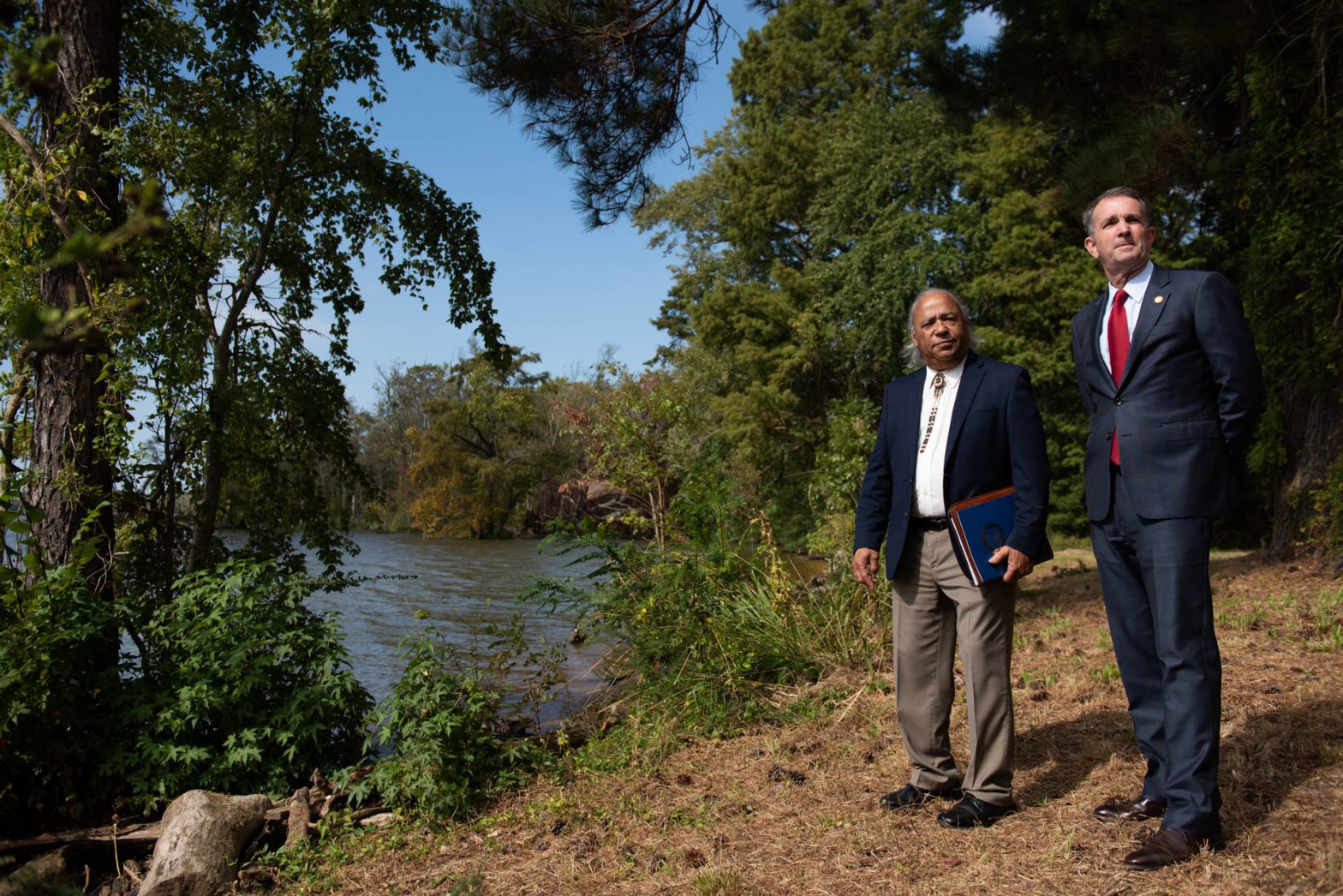
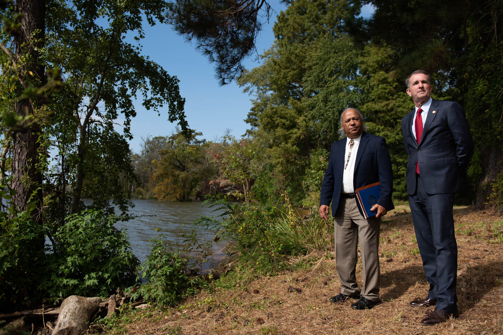
Chickahominy Chief Steve Adkins and Governor Ralph Northam on the banks of the James. Photo courtesy Office of the Governor of Virginia.

Four centuries after English colonists began systematically displacing Virginia’s indigenous people, the Chickahominy Tribe is reconnecting with the land of their ancestors thanks to the acquisition of 105 acres along the James River.

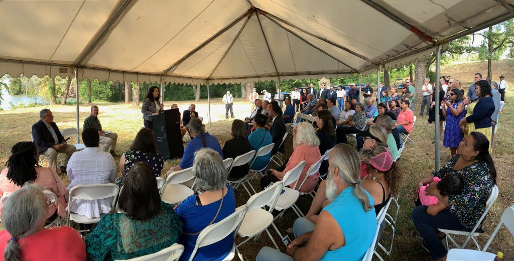
Chickahominy Chief Steve Adkins and other tribal leaders joined Governor Ralph Northam and officials from numerous state, local, and private organizations Friday to celebrate the acquisition of the site, called Chickahominy on the Powhatan—the name of the James River prior to English settlement.

VOF Executive Director Brett Glymph delivering remarks. Photo courtesy Office of the Governor of Virginia.

“In 1646, tribal land was taken from the ancestors of the Chickahominy Tribe, in present day Charles City County, not far from this site,” said Chief Adkins. “Now, more than 370 years later, the Commonwealth is returning land to the tribe. Within tribal culture, waterways are especially significant as they provide sustenance, recreation and travel/trade routes. This location allows us to celebrate, preserve, and share our culture and traditions with current and future generations.”

The site was purchased with the assistance of a $3.18 million grant from the Virginia Land Conservation Foundation (VLCF). The Virginia Outdoors Foundation (VOF), which holds an easement on the property, assisted the tribe with the grant application. The land, upriver from Jamestown Island, will be protected from development and will create a location to showcase the culture, history, and traditions of the Chickahominy Tribe.

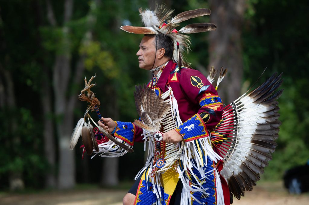
Chickahominy representatives blessed the land at the start of the ceremony. Photo courtesy Office of the Governor of Virginia.

“Our Commonwealth is full of cultural and historical sites and we must make every effort to protect and preserve their heritage, especially those that belong to or celebrate underrepresented communities,” said Governor Northam. “Returning land to the Chickahominy is an important step towards honoring their tribal history in Virginia and ensuring they have a place to continue sacred traditions.”

“We are proud and humbled to help the Chickahominy Tribe reconnect with the land and waters of their ancestors,” said VOF Executive Director Brett Glymph. “This project is right on every level—for the Chickahominy, for our Commonwealth, and for our nation.”

In addition to its cultural importance, the property will provide additional benefits like protecting scenic resources, Chesapeake Bay water quality, and wildlife diversity. It lies adjacent to Lawrence Lewis Jr., Park, which is known for bald eagles and herons.

Preliminary plans for the property, which has burial mounds and terraced settlement features, include a tribal office, a cultural education center, restrooms, interpretive period structures, information kiosks, and farm buildings and structures. The tribe, which was federally recognized by Congress in 2018, also plans to hold interpretive and cultural events open to the public once the site is further developed.

“Virginia’s natural resource agencies have been spending a lot of time talking about environmental justice, and this project is an excellent example of how we are putting those principles to work,” said Director of the Virginia Department of Conservation and Recreation Clyde E. Cristman.

Christie Reed Smith, Goochland County

Smith trains Newfoundlands in water rescue on her property.

Christie Reed Smith knows how to pack a lot of conservation value into a relatively small space.

A landscape manager by trade, Smith’s management of her 92-acre property in Goochland is a mix of sustainable farming practices and cultivation of wildlife habitat. She leases the bottomlands of her property to a farmer who employs rotational planting to control erosion, and she keeps the area around her house and pond in edge habitat.

Smith’s landscaping strategy has created a haven for coyotes, foxes, and songbirds. “I even heard a whippoorwill this year,” she says. “You don’t hear them much anymore.”

Once part of her great grandparents’ farm, and earlier forming a portion of Goochland’s historic Ben Dover Farm, the property fronts the James River for 1,500 feet. Smith states that the river was her main motivation for protecting the farm with a Virginia Outdoors Foundation easement in 2001. In addition to setting limits on impermeable surfaces on the property, the easement protects water quality by requiring a 100-foot vegetated buffer along the James.

“For the longest time the James was a dump site,” Smith says. “It was just a ditch that happened to have water in it. I heard about the James River Association’s work to protect the river and got excited about it. I wanted to do my part with the frontage I have.”

Smith also volunteers as a dog trainer with the Richmond Dog Obedience Club. She’s a member of Colonial Newfoundland Club and runs workshops on the property throughout the year, using the pond to stage water-rescue training sessions with Newfoundlands, a double-coated, web-footed breed particularly suited to working in the water.

She is pleased that the Greater Richmond community now understands the importance of the James to the quality of life in the city and beyond. “If you pay attention to the river,” she says, “you’ll attract all kinds of people who’ll want to enjoy it and take care of it.”

Captain Sinclair Recreational Area, Gloucester County

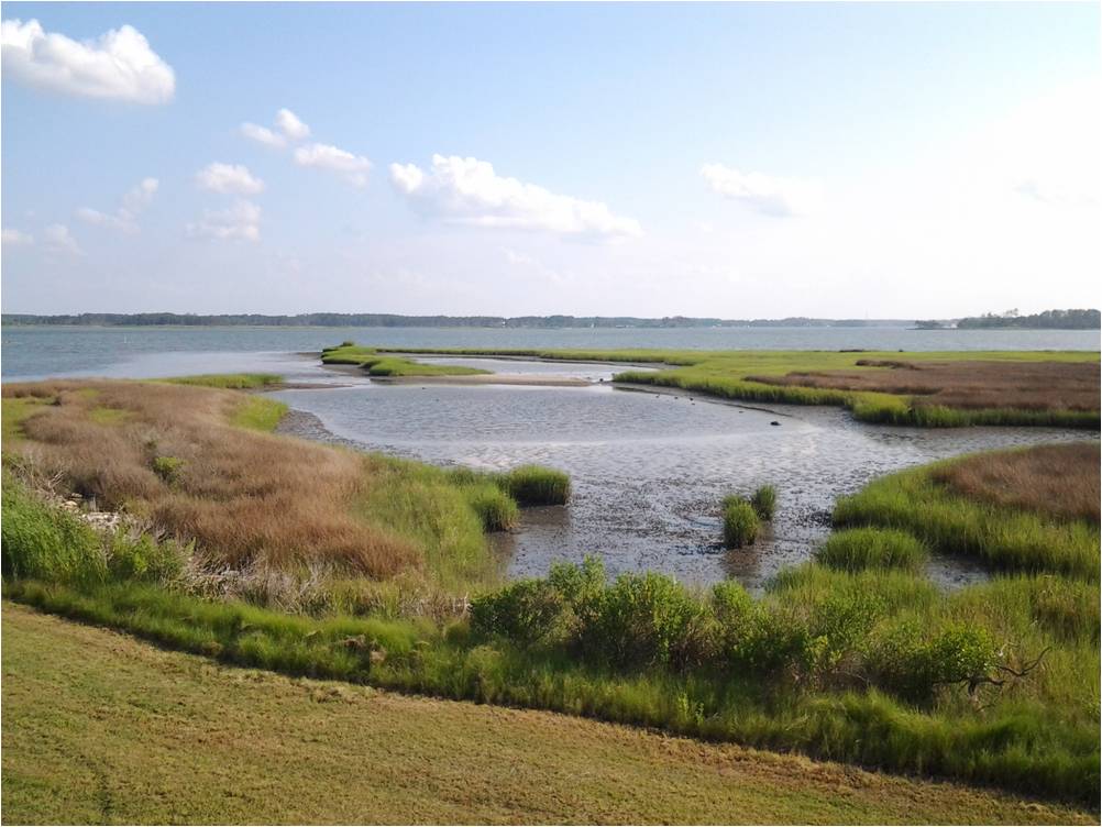
The wetlands and pier on Mobjack Bay provide fishing and wildlife viewing opportunities for visitors.

A fishing pier in need of repair, empty estate and pool houses, and a mile of riverfront with stunning views of Mobjack Bay: the recreational possibilities of the Captain Sinclair Recreational Area in Gloucester are easy to see, but getting the property to live up to its name has taken some time and creative thinking on the part of the Middle Peninsula Public Access Authority (MP-PAA).

Established in 2003 by the Virginia General Assembly, the MP-PAA is a single-purpose public entity charged with increasing Virginians’ opportunities to enjoy the Commonwealth’s coastal resources. The MP-PAA identifies and secures sites for public use, determines appropriate levels of use for each site, and implements corresponding management plans.

This work requires funding, however, and the MP-PAA has no state-allocated revenue stream to help in achieving its mission. It has received 41 parcels totaling 400 acres as charitable gifts since 2006 and has acquired another 725 acres through grant funds. The 97-acre Captain Sinclair tract was donated to the MP-PAA in 2014.

“We are land-rich and cash-poor,” says Lewie Lawrence, the MP-PAA’s executive director. “We don’t want to sell any of the property we’ve been gifted, we want to see it all in public use, but we need to provide the infrastructure to make these places accessible. That means thinking of creative ways to generate revenue.”

Partnering with the Virginia Outdoors Foundation is one way that the MP-PAA has been able to get the funds it needs to do its work. “When my board understood the opportunity that an open-space easement presents, we knew this was the solution for the Captain Sinclair property,” Lawrence says. Through a $180,000 grant from its Preservation Trust Fund in June of this year, VOF purchased an easement on the 40-acre portion of the property most suited for public use. This parcel includes the waterfront and existing structures as well as areas of mixed hardwood and pine forest and wetlands.

The easement limits development on this portion of the property and guarantees access to the public, and the grant money will allow MP-PAA to make needed infrastructure improvements. These improvements come from recommendations made by the Virginia Institute of Marine Science, with input and support from the Middle Peninsula Planning District Commission, The Middle Peninsula Public Access Authority Board, Gloucester County, and the citizens of Gloucester.

In the short term, the MP-PAA plans to use the money to replace the dock, add lighting and public signage, and grade and gravel interior roads, driveways and a parking area on the property. These improvements will make the shoreline portion of the property available for fishing and waterfront educational programs, such as guided oyster gardening and demonstrations of living shoreline restoration projects.

Future improvements include construction of an elevated boardwalk, and biking and walking trails on the drylands, marshlands and forest on the western portion of the property. Users of the trail will be able to reach two observation decks that look across the wetlands to the Severn River. Educational signage along the trails will describe the wetlands, forests, plant species, and common wildlife in the area. Bird-watching along the trails should be exceptional.

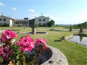
The estate house and gardens will be renovated and used as an event space.

Eventually the MP-PAA envisions restoring the estate house for use as an event facility and converting the pool house into a bait shop and kayak rental facility, both generating revenue for the continued upkeep of the site.

 “This property has so much potential to add value to Gloucester’s blue-green infrastructure,” says Lawrence. “We’ve been really thankful that VOF wants to walk this journey with us.”

Amenities available on the property now include a picnic area available to reserve for half- and full-day gatherings, reservable waterfowl hunting blinds, and several piers for launching kayaks, canoes, and paddle boards. For directions, or to reserve the picnic area or a hunting blind, click here.

Tucker Family Cemetery showcased during Hampton 1619 Commemoration

Last month the City of Hampton hosted a series of events commemorating the arrival of the first Africans in English North America in 1619, when an English mercenary ship brought the first African slaves to the shores where Fort Monroe now stands.

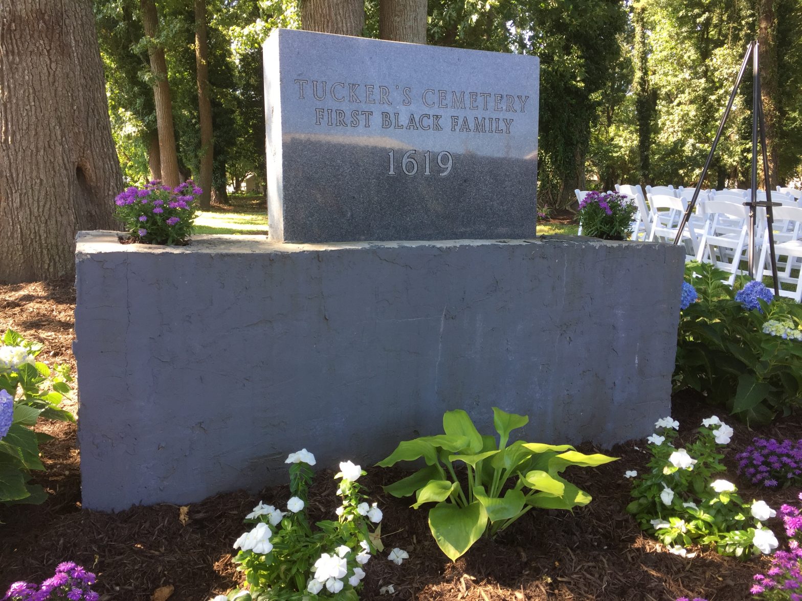
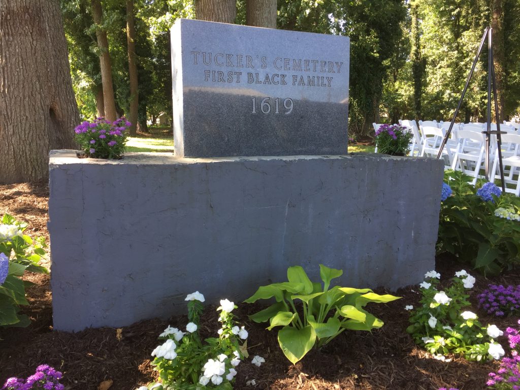
Nearby, the Hampton neighborhood of Aberdeen Gardens also observed the anniversary with a Reflection and Commemoration ceremony at the Tucker Family Cemetery. Here, tucked away on a couple of acres surrounded by homes, the tree-filled space holds the remains of the descendants of William Tucker, the first baby born to those enslaved Africans.

VOF made a grant of $100,000 last year from its Preservation Trust Fund to support the Tucker family in their efforts to preserve and restore the cemetery. An open-space easement on the property ensures that the parcel remains undeveloped with access to the public.

It is unknown whether Tucker himself is buried here. Preserving the space gives researchers time to find out, says VOF’s deputy director of policy and acquisitions, Leslie Grayson. “As technology advances, we will be able to learn more and more about this place. We could lose so much historical knowledge if this parcel were developed.”

Protecting the cemetery also complements the protection of the surrounding neighborhood, which is listed on the National Register of Historic Places and the Virginia State Register of Historic Landmarks. Of the 34 New Deal planned communities created to provide homesteads for the urban poor during the Great Depression, Aberdeen Gardens is the only one meant for black residents. It was designed by black architects and completed by black workers in 1937.

The 440-acre community holds 158 homes arranged on large lots meant to hold large vegetable gardens and small livestock for subsistence farming. The homes and the neighborhood remain remarkably intact thanks to the ongoing efforts of residents to resist encroachment from developers.

In their efforts to preserve the cemetery, the Tucker family formed a nonprofit, the William Tucker 1624 Society, which hosted volunteer clean-ups and in 2017 commissioned a survey using ground-penetrating radar that revealed more than 100 graves.

The society “considers the care and maintenance of this place to be a sacred obligation,” says Carolita Jones Cope, the family’s spokesperson.  “We hope others will be inspired to support cemetery clean-up efforts in memory of, and as an opportunity to honor, our ancestors.”

VOF’s support of the work at Tucker Family Cemetery, as well as historic Evergreen and East End cemeteries in Richmond, has elevated awareness of protecting historic black cemeteries.

 “These places are crucial to our understanding of African-American history,” says VOF Executive Director Brett Glymph. “Given how much of that history has been either lost or erased, it is imperative that we preserve the pieces that remain, to provide a complete picture of our shared heritage as a nation.”