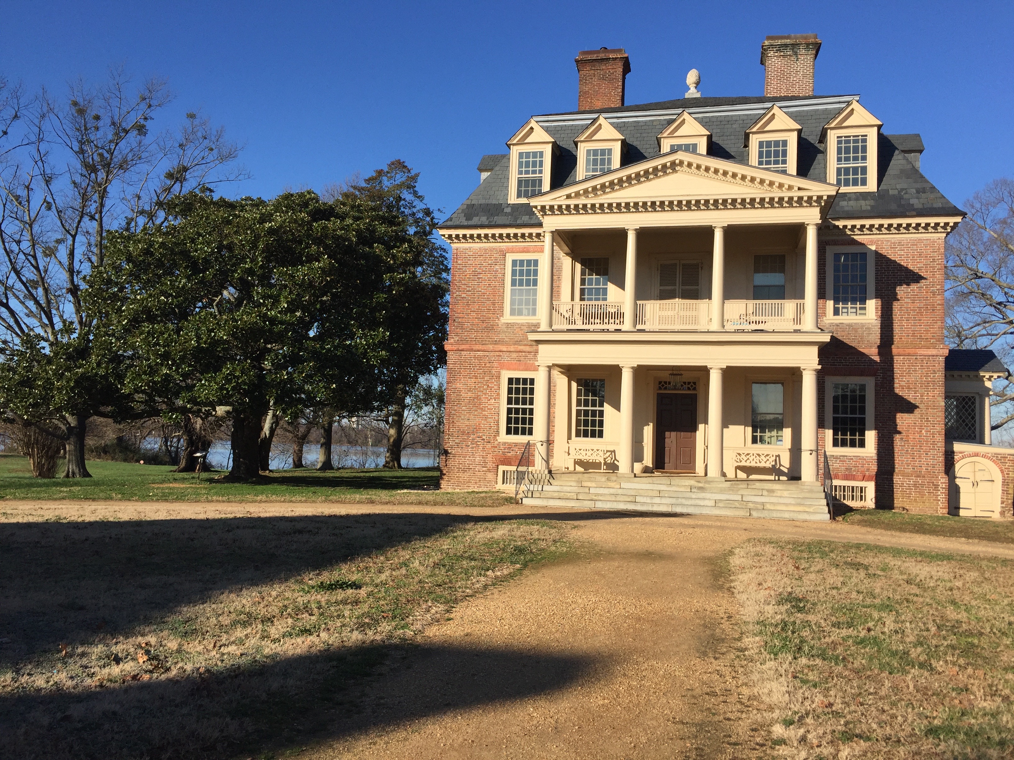
Shirley Plantation, Charles City County

Shirley Plantation, Charles City County
Completed in 1738, “Great House,” is largely in its original state and is owned and lived in by direct descendants of Edward Hill I.

As you walk up the drive to the “Great House” on Shirley Plantation, it’s hard to miss the three-and-a-half-foot wooden pineapple on the roof. A symbol of hospitality, pineapples appear in the woodwork inside of the house as well — a fitting accent to a home that has been welcoming visitors for over four centuries.

Founded with a land grant in 1613, Shirley Plantation came under the ownership of the Hill Carter family in 1638, and has been in the family ever since. The current owners, Charles Hill and Lauren Carter, are the 11th generation to live in the Great House and to welcome guests onto the 700-acre property.

Charles’ father was the first to open Shirley to daily tours, although records show that the property was a frequent destination for visitors even in colonial times. Guests since have numbered in the hundreds of thousands. It was inevitable that his father would open Shirley to the public, Charles says. “My father loved history, meeting people and sharing the heritage.”

That heritage starts with Shirley’s impressive architecture. Together, the Great House and its four remaining outbuildings form a symmetrical Queen Ann forecourt — the only one of its kind in the United States. Inside, on the main floor, a striking “flying staircase” — a staircase with no visible support — rises to the upper floors. The staircase is another architectural gem that is unique to the property.

Within the one-of-a-kind structures lies another heritage: the Great House, along with its remaining outbuildings, were built over the course of 15 years, starting in 1723, by slave labor.

“Before I came on board with the foundation, slavery at Shirley wasn’t talked about. It made people uncomfortable,” Lauren Carter says. “But to give a true history of a place you need to talk about everyone who played a part in it, from the first indentured servants to the enslaved and freed workers. These buildings wouldn’t even be standing if it weren’t for them. It’s everyone’s history.”

Exhibits within the intact storehouse and kitchen now testify to all the lives lived here, and are part of a walking tour in and around the buildings that highlights slaves’ daily lives: how and where they worked and lived, how many of them lived on the property at a given time, and what happened after they were freed.

On a separate tour of the Great House, visitors walk through the first-floor rooms, learning about the house’s unique architecture, and stopping in front of the family portraits that line the walls. As a guide tells the story of each ancestor’s stewardship of the farm, visitors may even hear the 12th generation of Hill Carters, Lauren and Charles’ toddlers, running across the hardwood floors upstairs.

For this family, history is embedded in daily life. “You feel their presence for sure, with all those portraits looking at you!” Lauren says. “Our two-year-old daughter always walks by them and says, ‘Hi people!’

“But you also feel this weight of carrying yourself honorably. Of taking care of this place. We think of ourselves as the stewards, not the owners. It’s a great privilege but also a lot of work.”

Preserving for the future while safeguarding the past informs everything the Hill Carters do on the property. The family’s latest project is replanting the “Sun Garden” near the house with native plants that attract pollinators. “It can be done beautifully and is period appropriate,” Lauren says. “And it’s a way of showing people the need for these plants.”

To help ensure protection of the family legacy on the property, Charles donated a conservation easement on the core part of the farm–126 acres that contain the historic buildings and gardens–to the Virginia Outdoors Foundation and the Department of Historic Resources in 2006.

Charles says, “The conservation easement made sense for the long term.  At the time of the easement, real estate was booming and it did not take much to see that, eventually, there would be a time when development came to the area around Shirley.

“No one wants to see un-complimentary land uses here, now or in the future, and the easement takes that off the table.”

Guided tours of the first floor of the house are offered for a fee, reservations recommended. Walking tours focusing on the lives of the enslaved people who lived and worked on the plantation are offered on select days and are complimentary with admission.

The grounds are open for self-guided tours daily from 9:30 to 4:30 for a fee. Grounds admission will be discounted until March 8.

Audio tours are available to download on your smart phone, and there is an interactive game for children that leads them from building to building with puzzles and explorative activities. A nature walk also leads visitors around the property to observe the  plants and animals on the farm.

Guided Tours of the “Great House” are $25 per adult and $17 per youth age 7-16, with a discount available for military, AAA, seniors, and groups of 10 or more. To book a tour, email info@shirleyplantation.com, or call 804-829-5121.

The next walking tours will be on Saturday, February 28th at 1pm and 3pm.

For more information on visiting the Shirley Plantation, visit http://www.shirleyplantation.com.
A Virginia Master Naturalist conducts a survey on everyone’s favorite arthropod at the preserve

A Virginia Master Naturalist conducts a survey on everyone’s favorite arthropod at the preserve
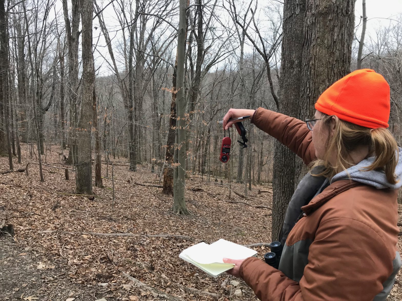
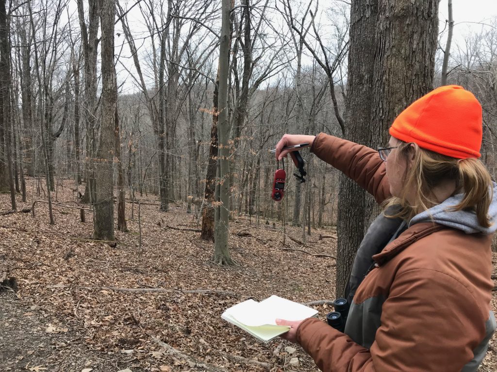
Virginia Master Naturalist takes measurements at one of her study sites on the preserve.

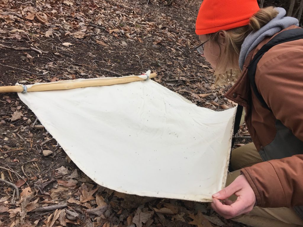
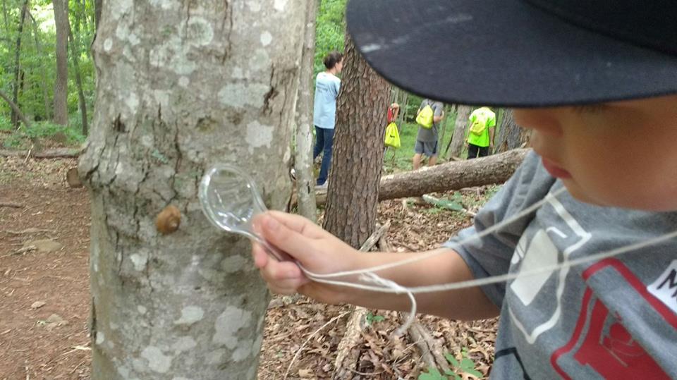
Want to hear a little about ticks? We know you do – they’re everyone’s favorite arthropod! The Preserve functions as a living laboratory, where several species monitoring projects are occurring at any one time, both by VOF-BRMNAP staff and outside user groups. Valerie, a member of the Merrimack Farms Virginia Master Naturalist Chapter, has just finished a tick monitoring study on the Preserve. She goes through her monitoring protocols at each of her survey sites: checking air temperature, humidity, and pulling a cotton-like fabric across the ground to attract ticks. She checks every few meters for ticks and collects any she finds as specimens to identify and further study.

A Virginia Master Naturalist conducts a survey on everyone’s favorite arthropod at the preserve
Valerie checks her survey cloth for any attached ticks.

Unfortunately for Valerie’s research purposes (but perhaps welcome news to our visitors), she hasn’t found many ticks on the preserve this year. Some possible hypotheses for this? Maybe it’s the incredibly wet year that we have had, or the larger range of animals throughout the preserve that cause the ticks to widely disperse… she’s not sure! But that’s the beauty of research – it can give you more questions and lead to more avenues for study!

All research on the Preserve, especially removal of flora and fauna, requires special research permits through VOF. This helps us ensure all research conducted on the preserve is ethical and helps us keep track of what is happening on the mountain. Next time you visit, ask VOF-BRMNAP staff about the monitoring projects occurring on the Preserve. We are always working to learn more about the unique ecology of Bull Run Mountains NAP to help us make more informed and effective management decisions.

Norfolk museum builds coastal resilience with living shoreline

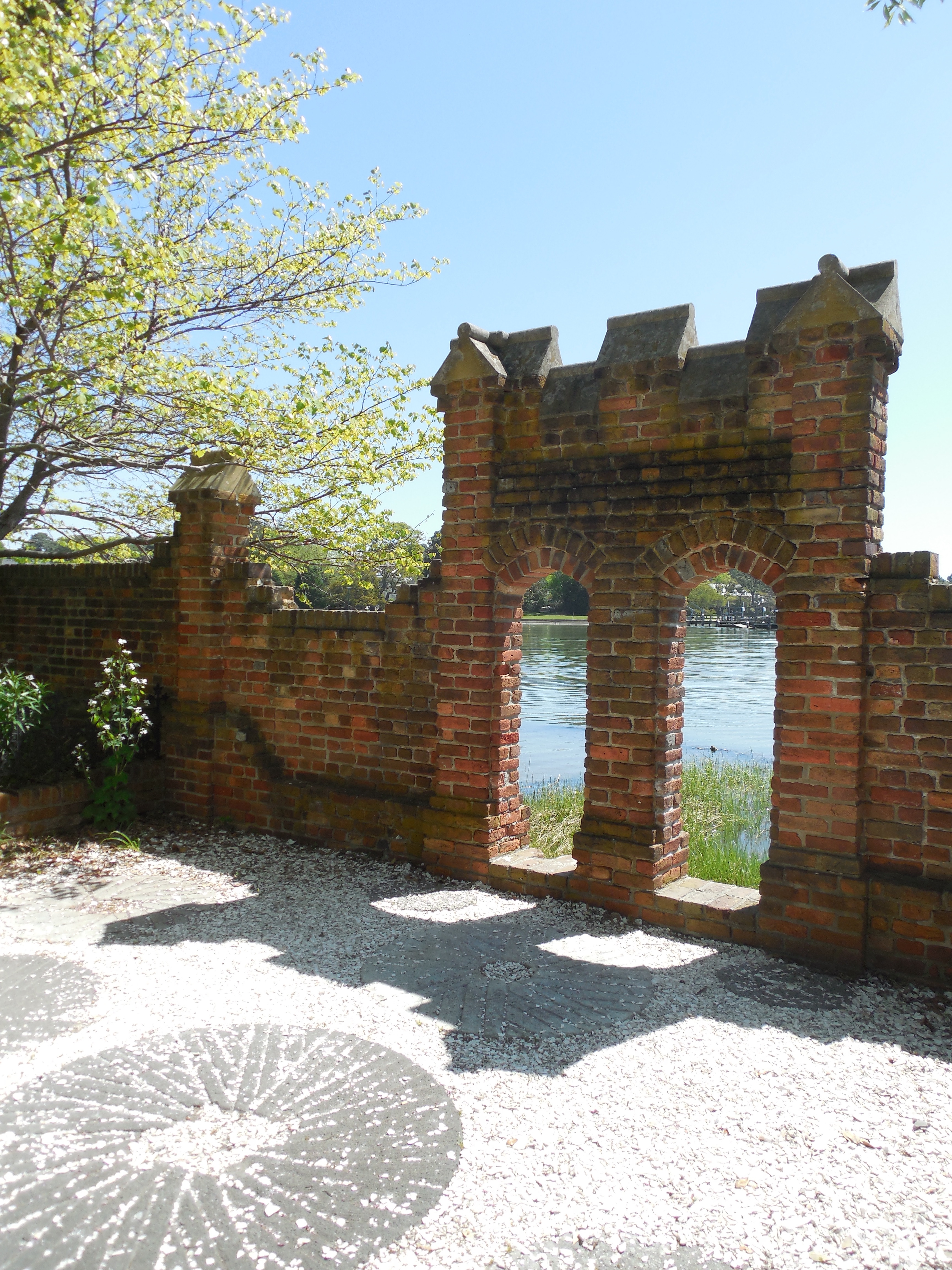
In the 1930s, a red brick wall stood between the iconic Hermitage Museum and Gardens in Norfolk and several hundred feet of undeveloped shoreline. By the early 2000s, the wall marked the edge of the Lafayette River, which had whittled away the shoreline after several devastating storms and increasingly higher tides due to sea-level rise.

While sea levels are rising all along the coastal U.S., they are rising two times faster on the Virginia coast. The U.S. Army Corps of Engineers has predicted that the water there could rise an average of 6 inches in the next 15 years and as much as 6 feet by the end of the century.

With help from city officials and federal grants, however, Hermitage is reclaiming some of its lost shoreline—and helping to improve Norfolk’s coastal resiliency.

In 2018, the National Fish and Wildlife Association (NFWF) and National Oceanic and Atmospheric Administration (NOAA) awarded Norfolk a $1.3 million grant to build a hybrid living shoreline and expand a riparian buffer along the Lafayette River. A hybrid living shoreline mixes low-profile hardscaping with natural buffers. Low stone walls, called sills, are built a distance out from the area to be protected or restored, and the space behind the sills is filled in with sand and planted with native marsh grasses, which stabilize the new shoreline by absorbing waves.

Eight living shoreline projects are underway in the Lafayette River watershed, where shoreline and infrastructure were severely damaged by Hurricane Sandy. The work is funded by a grant of $4,640,000 from NFWF, awarded in 2015 as part of the Hurricane Sandy recovery effort.

One of these projects is taking place at the Hermitage, where approximately 2636 linear feet of shoreline, including the Lafayette River and its inlets and coves, are being restored. Hybrid living shorelines will help stabilize the property’s wetland areas and prevent erosion of its forested shoreline.

“When we were picking potential sites for shoreline projects, the Hermitage was one area where we thought we could have the most impact,” city environmental engineer Justin Shafer says. “We could build on their past work in wetlands restoration and help stabilize some eroding areas, plus anything we did was guaranteed protection through a conservation easement. It was an easy decision for us to include them.”

The Hermitage donated a conservation easement to the Virginia Outdoors Foundation (VOF) in 2015, protecting the site from being subdivided and restricting impervious surfaces on the 16 acres to just 50,000 square feet. The easement also requires 35-foot riparian protection zones along the river and wetlands.

“Permanently protecting the property under easement gives staying power to the work the city is doing along the shoreline and to the work Hermitage is doing to educate the public,” says Brad Baskette, assistant director of stewardship with VOF.

The museum teaches the importance of wetlands as a natural resource to fourth-graders, offering hands-on opportunities to explore the wetlands on the property through its Wetlands Enrichment Tour. The funding from the city, along with the guarantee of protection through the easement, makes this work possible. It also has jumpstarted the next stage in the restoration process at the museum, says Hermitage’s executive director, Jen Duncan.

“In 2019 we are going to redo our master site plan that considers all of the things that it means to be on a peninsula on the Lafayette River. Thanks to the city, some are being addressed now, but the master site plan will look at requirements of the easement and what we know of the future developments. We will be looking for the areas of the property where we can safely move things out of the way of the river.

“It’s a map moving forward, given the realities of Norfolk,” she adds.

The efforts in Norfolk got a recent boost from the Commonwealth, when Governor Ralph Northam made addressing coastal resiliency a signature part of his administration’s agenda. He named his Secretary of Natural Resources, Matthew J. Strickler, as the Commonwealth’s Chief Resilience Officer. He also appointed Rear Admiral (Retired) Ann C. Phillips his Special Assistant for Coastal Adaptation and Protection.

In a press release announcing the appointment, Phillips emphasized the urgency of the issue. “As recent weather and ongoing coastal flooding events in this year alone have shown us, we have no time to waste.”

For landowners who are interested in restoring wetlands on their property, cost-share funding is available through federal programs, several non-profits, and state and local agencies throughout the Bay watershed. Go to https://www.wetlandswork.org/programs-planners for more information, and to search by state for funding opportunities. For cost-share funding specific to the Elizabeth River, go to https://elizabethriver.org/river-star-homes.

VOF and Enrichmond Foundation celebrate Evergreen easement signing at MLK Day cleanup

On a brisk January morning, during a day of service attended by hundreds of volunteers, families, and community leaders, the Virginia Outdoors Foundation and the Enrichmond Foundation closed the deal on a conservation easement that sets the stage for one of the largest restoration efforts of a historic African-American cemetery in the nation.

The announcement was made on January 21 as part of Enrichmond’s annual Martin Luther King, Jr. National Day of Service cleanup.

More than 200 volunteers braved temperatures in the mid teens to clear weeds from overgrown sections of the cemetery. At 11:00 a.m. a program was held in a heated tent that included performances by the Virginia Union University Choir, a libation ceremony conducted by Janine Bell of the Elegba Folklore Society, and an invocation by Rev. Dr. William Eric Jackson of the Fourth Baptist Church.

Following presentations by community members with family buried at the cemetery, VOF Executive Director Brett Glymph and Enrichmond Executive Director John Sydnor signed a ceremonial copy of the easement deed. Mayor Stoney issued a proclamation thanking VOF, Enrichmond, and the Evergreen Planning and Review Team for their work and encouraging all Richmond citizens to join the effort. Glymph also presented Enrichmond with the keys to a new tractor to help “lighten the load” for the staff and volunteers who maintain the property.

“The easement will provide for the permanent protection and restoration of this cemetery so that future generations can learn from the very important history that resides here,” said Glymph. “To our knowledge, VOF’s grant is the largest of its kind in Virginia history, and possibly the nation’s history. Today, we are recognizing the importance of the lives of the individuals buried here and their countless contributions to our city, to our commonwealth, and to our country, in spite of slavery, and in spite of the oppression of Jim Crow. We look to them for guidance as we continue our work of building community and creating a more fair and just society for all.”

John Sydnor thanked the many volunteers, family members, and city leaders who are supporting the effort. “This place is an amazing, sacred place,” he said. “When you come and are a part of the volunteer work, there is a spirit that takes hold of you. It’s a spirit of integrity, strength, and endurance, and it is made from the collective spirit of those who are interred here.”

With the recordation of the easement and transfer of funds from VOF, Enrichmond will now turn its attention to creating a master plan for the site, which is expected to take several years and require millions of dollars to implement.

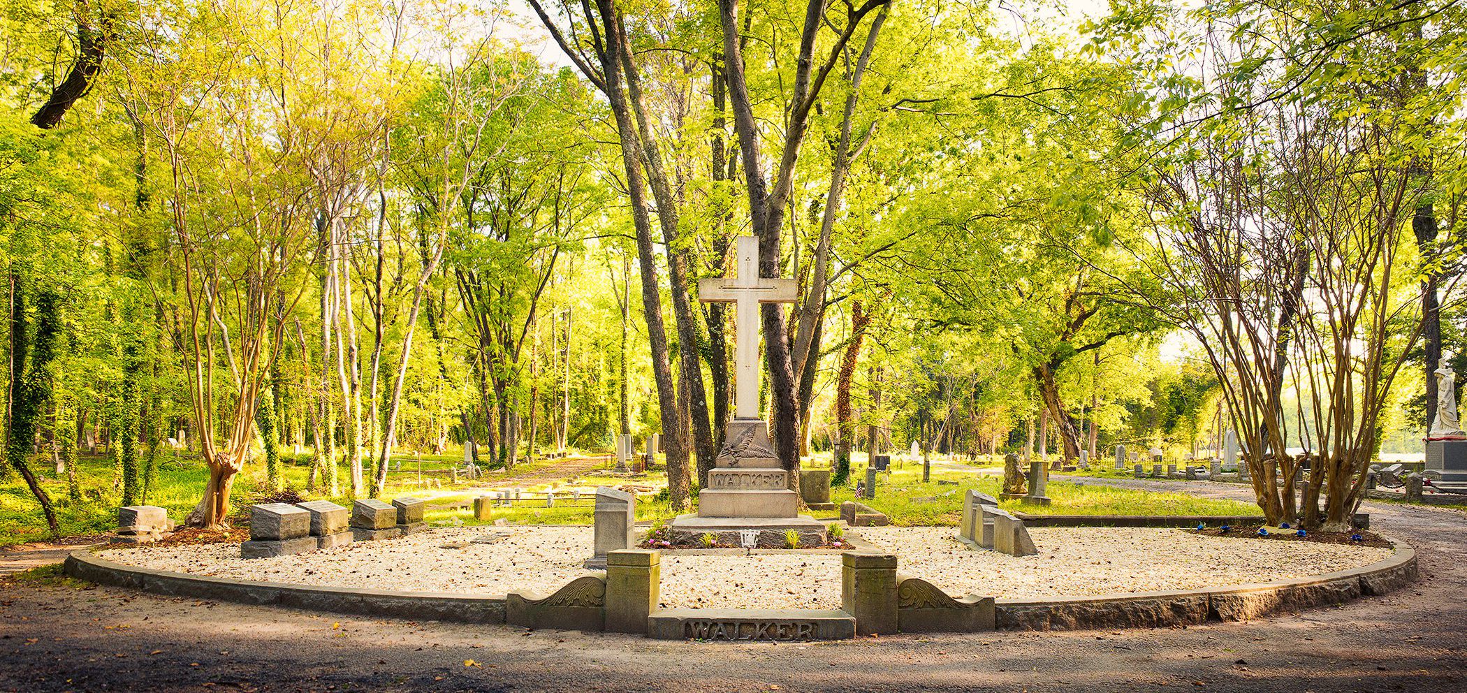
Evergreen Cemetery, located on 60 acres in the outskirts of Richmond, was created in 1891 as the final resting place for thousands of African-Americans who were born during or shortly after the end of slavery. Many of them became business, civic, and political leaders during Reconstruction, including the first African-American female to charter a bank in the United States, Maggie L. Walker, as well as businessman, newspaper editor, activist, and politician, John Mitchell, Jr.

Because of segregation, African-Americans could not be buried in white cemeteries. Founders created Evergreen as a monument to their achievements. Enrichmond estimates there are as many as 20,000 people buried at Evergreen, making it one of the largest African-American cemeteries in the nation.

As many African-American families fled Virginia during the early 20th century to escape racial violence and discrimination, the cemetery, which did not have a perpetual care fund, gradually suffered from overgrowth, trash and vandalism. Despite efforts by local volunteers to help care for graves, the property’s condition continued to deteriorate into the 2010s.

Work on the easement began in 2016, when VOF earmarked $400,000 from its Preservation Trust Fund for the project. The funding was contingent on protecting the cemetery with a conservation easement, which places development restrictions on the deed. First, however, Enrichmond had to acquire the property from a private entity. Enrichmond met with the owners over several months, and in 2017 negotiated its purchase. The foundation also hired a full-time caretaker and assembled a team of stakeholders to guide the process, composed primarily of people with family buried at Evergreen.

Among other things, the easement ensures the property will not deteriorate further, buildings must serve permitted uses such as education and visitation, and the property will remain accessible to the public.

Learn more, including how to get involved, at https://enrichmond.org/evergreen-cemetery/.

Claytor Nature Study Center, Bedford County

For all those 3- to 5-year-old adventurers with cabin fever, the Claytor Nature Study Center has a cure: a four-day “Animals in Winter” hike series that will get them exploring the forest throughout the month of February, searching for traces of wildlife and learning about animals’ winter survival strategies.

The center, nestled at the foot of the Blue Ridge Mountains near Bedford, offers opportunities to get outside once the weather warms up, too, with summer nature camps, monthly “night sky” viewing parties, community science days, the yearly International Outdoor Classroom Day, and the Earth and Sky Festival.

The center’s 491 acres were placed under easement with the Virginia Outdoors Foundation by then-owner A. Boyd Claytor III in 1998. He subsequently donated the land to Lynchburg College, which transformed it into a nature center.

At first, access to the center’s resources were limited to students of the college for lab experiences and to regional elementary schools for field trips. This changed a few years ago, says the center’s director, Dr. Greg Eaton. “After 20 years of environmental education programming for K through 12, we felt it was time to start reaching out to a wider swath of the public. We started to advertise, put up informational signs, kiosks with trail maps, and a registry. We recorded an increase in the number of people coming to the property almost immediately.”

Open to the public daily throughout the year, the center’s 7.5 miles of trails pass through upland and lowland forests, wetlands, and grasslands, with views of a lake, ponds, and a rocky stream segment of the Big Otter River. Views of the Peaks of Otter grace the western edge of the property and provide a scenic backdrop to weddings, conferences, and other special events held at Cloverlea, the 1780s-era farmhouse on the site.

Other facilities on the property include an astronomical observatory and a 7,700-square-foot education and research facility. The facility houses an integrated laboratory/classroom for Lynchburg students, a “Discovery Center” classroom for K-12 students, and connects to a wetlands observation deck. The center also boasts an eco-lodge that can host 16 people at a time for overnight visits.

But the state-of-the-art buildings depend on their setting. “What’s most striking about the property to me is that, even though it’s only 490 acres, there is such an incredible diversity in the landscape,” Dr. Eaton says. “It’s amazing that such diverse terrains exist in this space. There are even remnants of plantation plantings. It’s a remarkable resource for all of us.”

For the public, the upcoming Earth and Sky Festival (to be held April 20th, the Saturday before Earth Day) will host hikes, workshops, and, once the sun sets, night sky viewing. “Because of our location away from city lights, we have one of the darkest night skies this side of the Blue Ridge. The festival is a way to give back to the community, but also highlight the connections between what exists on the ground and what we see in the sky,” Dr. Eaton says.

For the university, current use of the site includes on-site sessions for biology, chemistry, and environmental science classes, serving roughly 800 students per year. Use of the facility is growing across the curriculum, with visits by literature, history, creative writing, and art classes, increasing every year. Extra-curricular student organizations are also taking advantage of the natural setting for retreats. “We’re starting to call it our ‘Blue Ridge campus,’” Dr. Eaton says.

More immersive experiences are in the works. Dr. Eaton and other faculty and staff are preparing for the center’s first “J-term” offering: a four-week course on winter ecology that will run between the end of fall classes in December 2019 and the beginning of the spring semester in January 2020. Students will live and study on site.

“It will be the first chance for students to experience the center as their home,” Dr. Eaton says. “I’ve often thought that it would be ideal if every student could spend one night outdoors at the center. Sleeping under the stars or in a tent, you can really begin to understand what nature has to offer, as well as its challenges.”

Announcement planned for MLK Day regarding project at Evergreen Cemetery

The Virginia Outdoors Foundation (VOF) and the Enrichmond Foundation will announce a major milestone in our efforts to protect and restore historic Evergreen Cemetery in Richmond on January 21, during a community cleanup event that’s part of the Martin Luther King, Jr. National Day of Service.

Evergreen is the resting place for thousands of individuals who faced segregation, discrimination, and racial violence while contributing in important ways to the city’s — and the nation’s — vibrant social, political, intellectual, and religious life. Among those who rest here are such luminaries as Maggie L. Walker, John Mitchell, Jr., Dr. Sarah Garland Boyd Jones, and Rev. J. Andrew Bowler.

The partnership between VOF and Enrichmond began in 2016, when VOF allocated $400,000 from its Preservation Trust Fund to conserve the cemetery, which had suffered from decades of weeds, trash, vandalism, and neglect despite heroic efforts from volunteers to maintain it. VOF began working with the Enrichmond Foundation, community leaders and volunteers, and people with family buried in the cemetery on a plan to acquire, conserve, and restore the 60-acre site with state support, as well as neighboring East End Cemetery. Enrichmond completed its acquisition of the property in 2017, hired staff devoted to its care, and assembled a team of community leaders and volunteers — most of whom have family buried at the cemeteries — to guide the community engagement and restoration processes.

The cleanup activities will begin at 9am, and a program with speakers and a performance by the Virginia Union University Choir will begin at 11am. Click here for more details about the event, including information about parking, shuttles, a free GRTC bus rides to and from the event.

Please call cemetery caretaker Ted Maris-Wolf at (804) 234-3905 x105 or visit https://enrichmond.org/evergreen-cemetery/. For updates. You can also follow VOF and Enrichmond on Facebook at https://www.facebook.com/virginiaoutdoorsfoundation and https://www.facebook.com/EnrichmondFoundation/.


Volunteers enhance the preserve’s trail system through monthly trail workdays

Volunteers enhance the preserve's trail system through monthly trail workdays
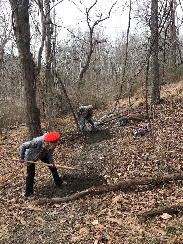
Volunteers cut in a section of new trail.

Without the invaluable help of all our volunteers, we would not be able get all our work done on the Preserve. Potomac Appalachian Trail Club (PATC) volunteers braved the cold weather this morning to help build a new section of trail; benching the trail and creating rock steps to help navigate tricky, wet areas. This trail has been constructed to re-route a portion of the now stream-covered Green Trail to help keep our hiker’s feet dry. Every month, PATC volunteers come out for a trail workday to cut downed trees, build and maintain trails, and manage invasive species on the Preserve, to name a few essential activities.

We always welcome and are looking for new volunteers to come out to the Preserve! Field season is approaching, and we have many future volunteer opportunities, ranging from invasive species work, species monitoring projects, trail work, and more. If you are interested in volunteer stewardship work, email Preserve Technician Summers Cleary at scleary@vofonline.org and she will add you to the volunteer list! Or, if you have any questions about the work we are doing on the preserve and potential volunteer work, you can also shoot Summers an email!

VOF protected 15,928 acres of open space in 2018

The Virginia Outdoors Foundation (VOF) recorded 70 open-space easements in 41 counties and cities in 2018. The 15,928 acres of newly protected land includes VOF’s first easements in the cities of Alexandria and Richmond. Ten of the projects require permanent public access to the land. These projects received about $1.3 million in funding from the foundation’s Preservation Trust Fund and include the following:

  • Hansborough Ridge in Culpeper County, a Virginia Historic Landmark and part of the Civil War Brandy Station Battlefield
  • The Hottel Keller Homestead in Shenandoah County, site of the Shenandoah Germanic Heritage Museum
  • Hazel Hollow, an 11-acre tract that will provide greenway access to the New River in Pulaski County
  • The historic garden adjoining the Murray-Dick-Fawcett House in the City of Alexandria


The remaining projects were mostly donated easements on privately owned, working landscapes. Open-space easements allow landowners to restrict future residential and industrial development on their land, while continuing compatible uses such as farming and forestry.

Because of the public benefits of open space such as improved water quality and wildlife habitat, easement donors are eligible for federal and state tax benefits.

VOF now protects more than 835,000 acres of open space across Virginia. These lands help to protect more than 4,200 miles of streams and rivers, 237,000 acres in ecologically significant landscapes, 386 miles along designated scenic roads and rivers, 333 miles of threatened and endangered species waters, and 147 miles along designated hiking and biking trails. Since being established by the General Assembly in 1966, VOF has preserved open space at a rate of nearly two acres every hour. About 95 percent of all Virginians live within 10 miles of VOF-protected land.

The Clifton Institute, Fauquier County

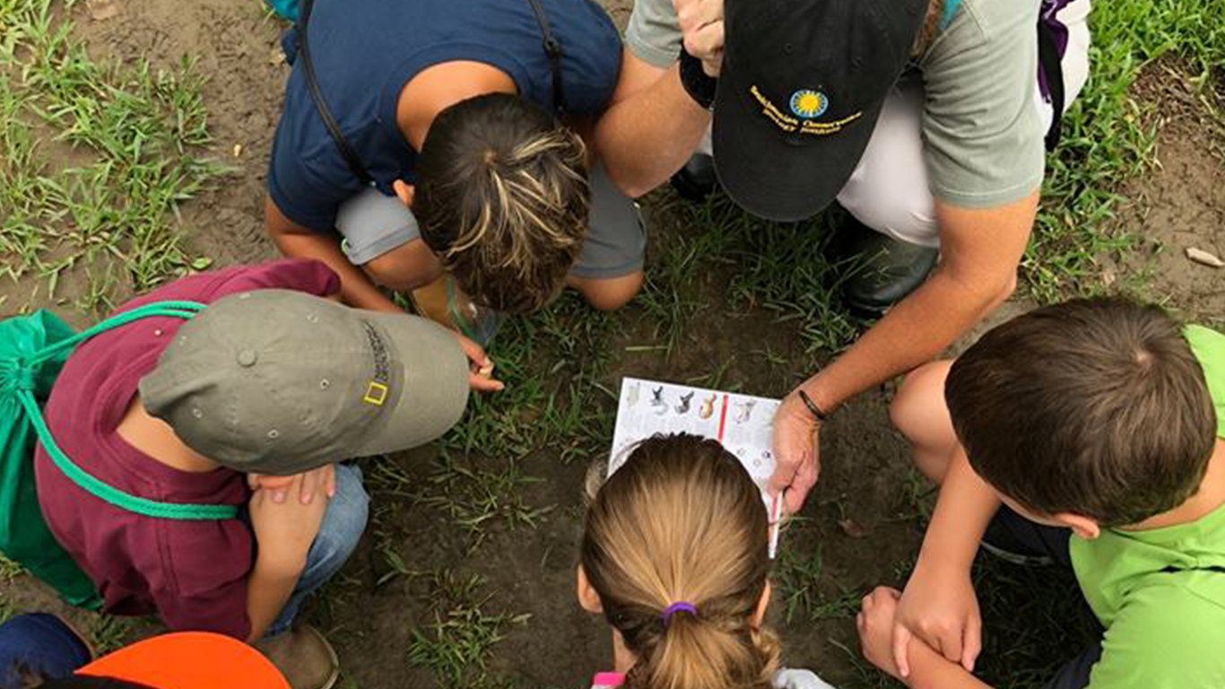
A ring of children crowd around a kneeling camp counselor, who holds a dragonfly just inches from their faces.

“How can you tell this guy is a predator?” the counselor asks.

“Big eyes!” one child volunteers.

“Spiky legs to hold prey!” another says.

This is a typical scene at the Clifton Institute, an environmental education center and research station located in Fauquier County, about an hour’s drive from Washington, D.C. Protected by a VOF easement since 2008, the 900 acres of eastern deciduous forest and open fields serve as a biological field station, providing an outdoor classroom and living laboratory to researchers, students, and the community at large.

“Our goal is to get people to realize what they’ve got in their own backyard,” says Bert Harris, the Institute’s executive director. Bert and his wife, Eleanor, who is managing director of the Institute, are both biologists and adjunct professors at American and George Mason Universities.

They are also part of a new team that is growing the Institute’s work in research, ecological restoration, and education. Research experiments are being conducted on the property now that measure the importance of vernal pools for salamander populations and the effects of cows on soil quality and habitat. In addition, members of the community are taking to the trails to catalogue the species present on the property with iNaturalist — an online, crowdsourcing website where naturalists, citizen scientists, and biologists can share their observations. So far, they’ve discovered more than 730 species on the Institute’s grounds and have catalogued them at https://www.inaturalist.org/places/clifton-institute-field-station.

Restoration initiatives include restoring 300 acres of native grassland and shrub fields on the property. “We’re planning a huge experiment,” Bert says. “We want to plant 10-acre blocks with different seed mixes and try different methods of maintenance, such as prescribed fire and tilling. The goal is to see which treatment works best for establishing a functioning native grassland. This way we can educate landowners from what we find out.”

Landowners aren’t the only ones benefiting from the Institute’s work. A newly hired full-time educational associate, Alison Zak, is establishing a curriculum for students of all ages. She and other staff will have their hands full in 2019, as the Institute expects to host 800 elementary, middle, and high school students from private, public, and home schools in its outdoor classroom.

The Institute’s monthly Saturday youth hike is a popular activity for kids 5 and up, who can learn about ecology, conservation, and different species native to the Piedmont region while having fun outside. For adults, bird walks and naturalist seminars conducted by experts several times a month are an opportunity to learn about wildlife in the field.

The Institute is a nice fit for a county that has long embraced land conservation. Fauquier is VOF’s largest county for easements, with 71,000 acres protected. VOF also owns and manages the nearby Bull Run Mountains Natural Area Preserve, a popular destination for hikers and an important block of habitat that’s just a 15-minute drive from the Institute.

Despite the conservation success in the area, residential and commercial development pressure continues. “Urban sprawl in this area is advancing pretty fast, and there is still so much here to save,” Bert says. “Ours is one of the bigger properties in the region. Just knowing it will always stay that way is fantastic. We’re trying to convince our neighbors to protect their land, too.”

VOF announces $3.6 million for forest conservation in Southwest Virginia

The Virginia Outdoors Foundation (VOF) today announced $3,629,710 in grants to support seven on-the-ground projects that protect and restore forests in Giles, Roanoke, Montgomery, Botetourt, Rockbridge, Bedford and Pittsylvania counties. Several of the projects will also create new opportunities for outdoor recreation and education in their communities.

These grants were awarded from the Forest CORE (Community Opportunities for Restoration and Enhancement) Fund — a component of VOF’s TERRA program, which administers funds resulting from legal and regulatory actions involving Virginia’s natural resources. The Forest CORE Fund was established with $15 million received by the Commonwealth of Virginia to mitigate for forest fragmentation caused by the Mountain Valley Pipeline.

Forest fragmentation occurs when large, contiguous forests are broken into smaller forests separated by roads, utility corridors, housing, and other development. Fragmentation can weaken forest health resiliency, degrade habitat, interfere with the movement and reproduction of animals, and increase invasive plants and other pests, resulting in loss of biodiversity.

This first round of grants was announced in August 2018, and a second round is expected to open in early 2019. The expenditure of the funds is tied to the tree-clearing and grubbing activity of pipeline developers. Approximately 48 percent of the pipeline right-of-way in Virginia has been cleared and grubbed to date.

Said VOF Executive Director Brett Glymph, “When selecting grant recipients, our board looked at not only projects that offset the permanent loss of forest cover caused by the pipeline, but also at projects that would yield other benefits to local communities, such as providing new opportunities for public access for recreation and education, as well as wildlife habitat, scenic viewsheds, and water quality.”

VOF staff met with local officials, planning districts, conservation partners, and state agencies during the program creation and application process to make sure that community needs would be well represented in scoring criteria.

The projects that have been approved for funding are:

Chestnut Ridge, Giles County, $915,500

The Virginia Department of Conservation and Recreation proposes to acquire 808 acres of forest in one of the highest-rated and least-protected ecological cores in the region. The proposed acreage provides a key buffer to a documented stand of old-growth forest, which is partially protected on an existing State Natural Area Preserve. If acquired, the acreage would receive the highest protection that can be afforded under state statute and be managed for the long-term benefit of an intact significant natural forest community, including American chestnut and butternut — species that have been widely decimated throughout the region.

Poor Mountain-Greenways Connector, Roanoke County, $500,000

The Virginia Department of Conservation and Recreation proposes to acquire 279 acres of intact pine-oak-heath forests that adjoin an existing State Natural Area Preserve. This acreage complements the Roanoke Valley Greenways plan. All acreage will be permanently protected, thereby minimizing long-term forest fragmentation in a mapped ecological core and protecting the viewshed for the City of Salem and other residents. The tract will also support efforts to assemble a landscape-scale site that may allow for the reintroduction of fire as an important natural disturbance, as well as bring added protection to a globally rare woody shrub species.

Brush Mountain Preservation and Park, Montgomery County, $1,205,800

The New River Land Trust, in partnership with the Poverty Creek Trails Coalition, proposes to purchase 553 acres of intact forest on the Brush Mountain ridgeline in and adjacent to the Town of Blacksburg and Virginia Tech in Montgomery County. After purchase, the properties will be transferred to public ownership and be preserved as forested public parks. The project will create community open space with a system of multi-use trails available for recreation and nature-based educational programs.

Appalachian Trail Core Forest and Viewshed Protection, Botetourt County, $376,500

The Appalachian Trail Conservancy proposes to acquire 243 acres of high-quality forest to preserve the Appalachian Trail footpath at Tinker Cliffs, buffer Carvin’s Cove, and protect the viewshed of McAfee Knob, which is one of the most photographed vistas on the Appalachian National Scenic Trail. The property will be ultimately transferred to the National Park Service.

Mystic Forest, Rockbridge County, $360,000

The Virginia Outdoors Foundation proposes to acquire open-space easements on land that will connect Adams Peak — a designated “roadless area” of the George Washington National Forest and eligible for wilderness designation — with orphaned parcels of forestland owned by the U.S. Forest Service in Rockbridge and Amherst counties. At the center of the project is 40 acres of old-growth forest that has been owned by the same Monacan Indian family for nine generations. The property contains trees more than 300 years old. When finished, roughly 15,000 acres of pristine forestland will be connected for wildlife and recreation.

Explore Park Forest Preservation, Bedford and Roanoke Counties, $165,450

Roanoke County proposes to purchase several properties adjacent to Explore Park and within the viewshed of the park, which is a public recreational facility. The project will preserve the existing forests and viewsheds for the Blue Ridge Parkway and Roanoke River Parkway, prevent development of the properties, and provide public access for outdoor recreational activities such as hiking, biking, fishing, and bird-watching.

Wayside Park Trail, Pittsylvania County, $106,460

Pittsylvania County is working to create one mile of multi-use, crushed stone trails in Wayside Park by integrating a 3,780-foot park maintenance road and an existing 1,500-foot trail previously constructed by a local Boy Scout troop. This trail project is part of a larger master plan to renovate the nearly 100-year-old park to return it to its former glory as a community asset and beacon of conservation and recreation. The park’s size and natural resources including Sycamore Creek that runs through the park, abundant wildlife, and forest covering more than 37 acres of the park, making it the largest county-owned park in Pittsylvania County. The project will permanently prohibit commercial timbering on the property, and funds from the grant will assist with trail development.