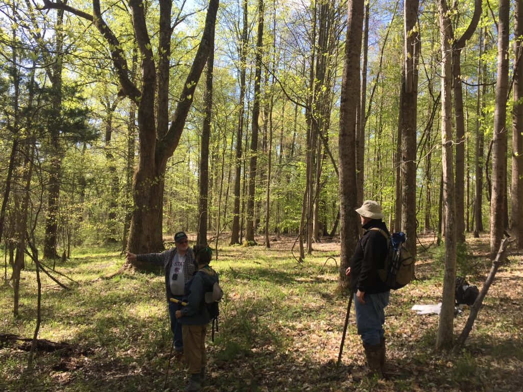
Bittersweet News – Thanks, and farewell, to our Preserve Specialist, Summers Cleary

Dear Preserve Community,


Some of you may already found yourselves privy to this information, but I am now writing to inform you all of the bittersweet news that Summers Cleary will be leaving VOF.  


Although her time here was much shorter than we would have liked it to have been, I can confidently state that it has been an incredibly intense and productive 3 years.

I also want to share that our accomplishments here over the past 3 years would not have been possible without Summers’ expertise and dedication.

She is a natural leader that helped us confront (what feels like and very well may have been!) a new challenge or unknown at a DAILY pace.


As a GIS specialist, cartographer, and visual artist, Summers should get kudos for how we present our Bull Run Project to the world. In addition to this, she embodied our community-based approach to conservation and our “VOF preserve-first” work ethic. We have a very small team here, and needless-to-say there is zero redundancy. That is to say, that Summers has had the chance to touch nearly every part of our work here over the past three years.

I am positive that her contributions will remain a valued and memorable piece of this dynamic project’s bedrock for many years to come. She will, and should be, remembered as a pioneer of a project that is still in its relative infancy.


With Summers now heading out west to Colorado, I find it incredibly fitting. As 1) I know that the state has a deep and early sentiment for her, and 2) Colorado’s state bird is the lark bunting (Calamospiza melanocorys).


For those unaware, a lark bunting is a spirited sparrow that is known for its optimistic personality, positive energy, and cheery song. I can testify that Summers brought a, at times MUCH NEEDED!, “lark bunting energy” to her work. Further, this bird symbolizes both intelligence and knowledge, and it is said that it distills these qualities into its presentation (or song). And I believe that Summers did the same for us – combining a scientific approach, an uber-professional competence, and some notable artistic abilities into each and every work product.


In Colorado, I am happy to share that Summers will be working as part of the National Audubon Society’s Enterprise GIS team, where she will help communicate the value of GIS and spatial thinking (within Audubon and to the general public) through the creation of integrated web-applications and spatial storytelling through StoryMaps. She will also provide technical assistance for the use of GIS on multiple scales across Audubon’s national office, state center’s and the 500+ chapters.


To close this email, I just want to say that I couldn’t have found a better human to spend 3 years working with on the mountain. And I wish her nothing but the best as she starts this exciting new chapter in her life!


With appreciation,

Joe


PS – For all those who have read this far, I just want to announce my brazen new VOF initiative: Demanding the state of Colorado promptly, and apologetically, return Summers Cleary to VOF! 😉


A report from the field: Snake hunting with a local legend

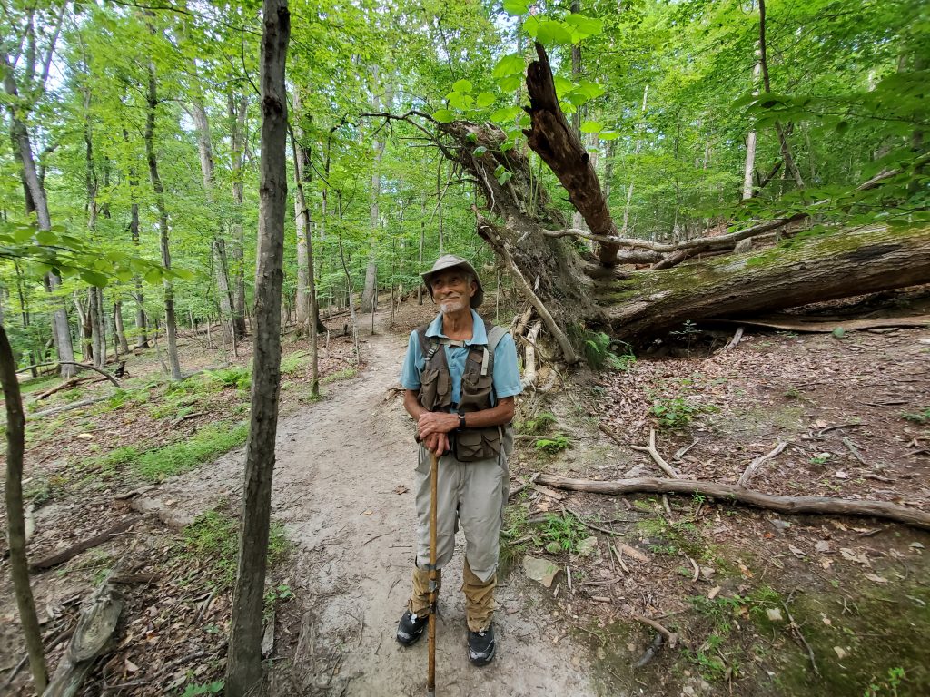
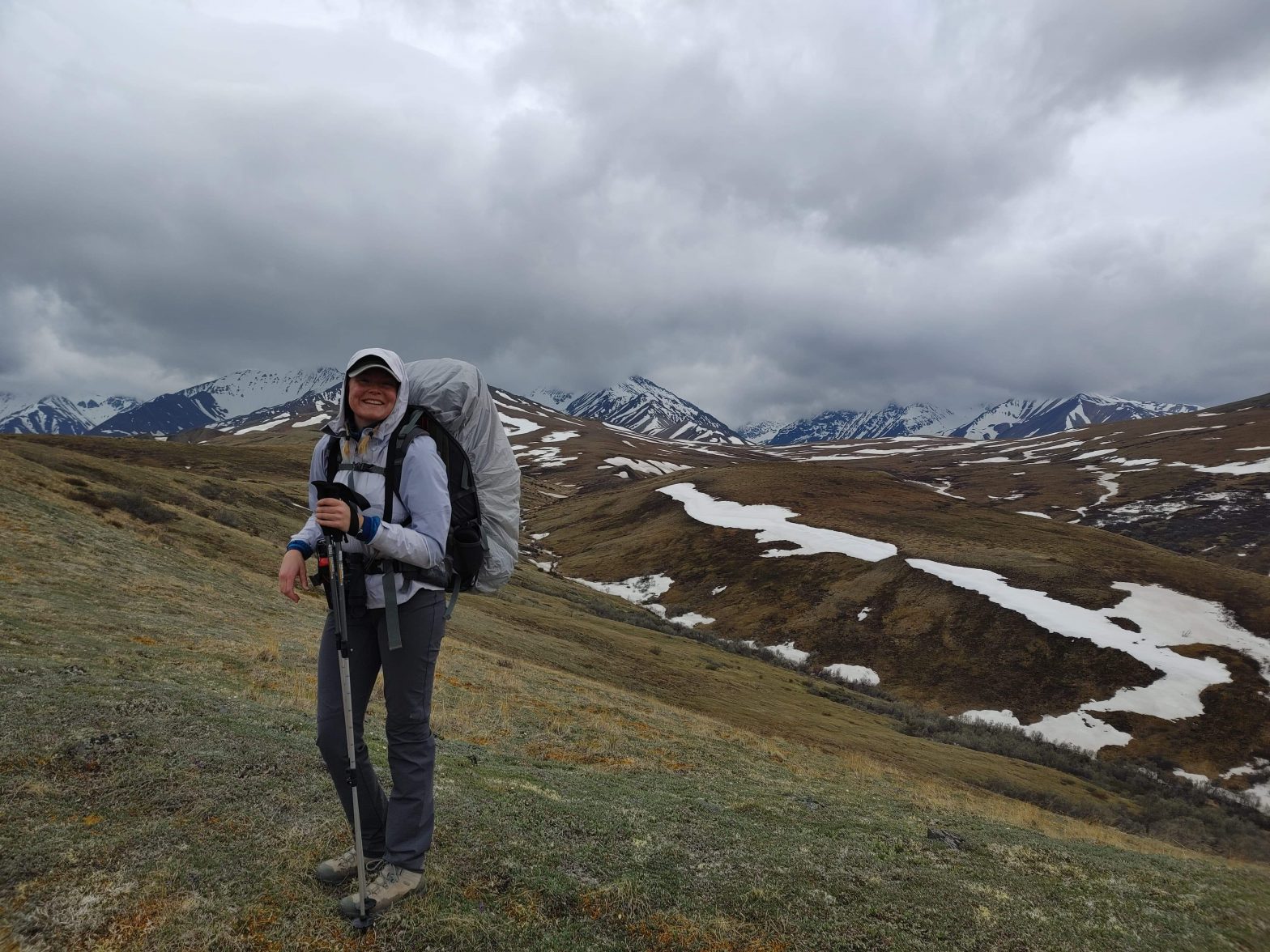
This is Marty Martin, timber rattlesnake expert and absolute legend.

A report from the field: Snake hunting with a local legend

He has been hunting rattlesnakes in our area since he was a young child. His youth, in the 1950s, was filled with taking our area’s best herpetologists out to sites to show them where venemous snakes weren’t yet documented. This snake hunting eventually turned him on to ecology and the thought of pursuing college. With that, he joined our armed services to help him afford such an education.

Once in the military, he was selected to fight as a bantam weight boxer. After taking a few punches and delivering many more, he eventually hung up the gloves to fight in the Vietnam War.

After that, he spent many years traversing across several of the most dangerous places on earth (constantly seeming to find himself at ground zero for a newly emerging disease, civil war, and many other disasters).

In addition to these notable experiences that have nothing to do with snakes (but totally help you get to know Marty better), he was one of the founding members of the Virginia Herpetological Society (at only 15 years old), currently serves on the IUCN task force focused on timber rattlesnake conservation, and was the field naturalist who took Steve Irwin to find timber rattlesnakes to film for his show, The Crocodile Hunter.

Creeping up to 80 years of age, I am proud to state that today was another first for him. As we spent 7 hours climbing up and down the rocky face of a mountain – and he said it was the single ABSOLUTE WORST snake survey trip he ever had at this particular site!

Completely skunked. Not even a shed skin.

Knowing that Marty’s happiness is completely tied to the presence and well-being of local venomous snakes, I tried to point out the other natural wonders we were encountering. A feeble attempt of distraction, I walked along saying, “still a nice day to be outside though”, to which he eventually stopped.
The silence of his sudden non-movement making me whirl around to catch his gaze. 

There Marty stood staring at me with a comically puzzled look and said, “NO, ITS NOT!”.

With the life this man has lived, scratch that – SURVIVED – I am honored I could experience one of his ultimate downs with him.

Grants available for public open space projects, easement assistance

The Virginia Outdoors Foundation is making $1.825 million available from its Preservation Trust Fund (PTF) and Get Outdoors (GO) programs for grants that protect open space for public benefit.

Of the total, $1.075 million is reserved for PTF Public Access grants, which may be used to acquire land, easements, rights of way, lease agreements, or other interests in real estate that result in significant public access. The real estate interest must either be acquired by a local government or conveyed to VOF to be eligible for funding, and protection must meet the requirements of Virginia’s Open-Space Land Act.

Another $350,000 is reserved for PTF Easement Assistance grants, which are available to income-eligible landowners who wish to donate an open-space easement to VOF on their property. Easements allow land to be lived and worked on while limiting development rights to protect water quality, prime farming soils, wildlife habitat, and other conservation values. Easement Assistance grants may help pay for any costs that are associated with conveying the easement to VOF, including legal fees, appraisals, processing fees, and survey costs.

The remaining $400,000 is reserved for GO grants, which prioritize projects in communities that have been inadequately served, overlooked, or marginalized by unfair zoning, housing, and land-use practices or other systemic discrimination. The grants may be used to fund infrastructure, studies, planning, and capacity building to enable safe use of, or access to, public open space, as well as for acquisition. Individual projects may receive no more than $25,000. The minimum grant amount is $500.

The application deadline for PTF Public Access and GO grants is 11:59 p.m. EST, August 20, 2021. PTF Easement Assistance grants are offering on a rolling basis as part of the easement donation process. Application forms, eligibility requirements, and other materials may be found online at https://vof.org/ptf and https://vof.org/go. VOF encourages potential applicants to contact staff prior to applying to discuss eligibility and seek guidance on producing a successful application. Contact grants@vof.org or (434) 282-7054 with questions or for information on how to apply.

VOF Preserve Staff participate in Reserva: The Youth Land Trust 5k Fundraiser

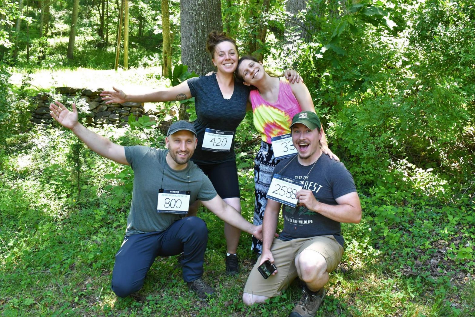
As mentioned in a recent post our Preserve Manager, Joe Villari, got together a local team (VOF Research Associate, Michael Carr, Preserve Volunteer, Sarah Causey, and former VOF Special Projects Fellow, Kellen Hope) to participate in our friends and partners, Reserva: The Youth Land Trust’s 5k event!

VOF Preserve Staff participate in Reserva: The Youth Land Trust 5k Fundraiser
Team Andean Ssssnaileater. Top left to bottom right: Preserve Volunteer Sarah Causey, former Special Project Fellow Kellen Hope, Preserve Manager Joe Villari, Research Associate Michael Carr. Photo by Michael Carr
VOF Preserve Staff participate in Reserva: The Youth Land Trust 5k Fundraiser

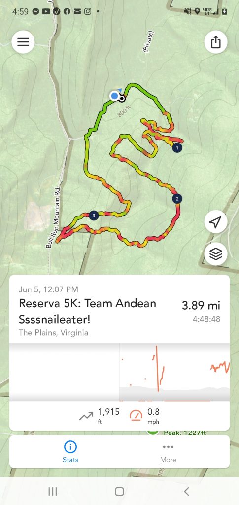
In true Preserve style, they decided to turn the 5k into a 3.89 mile mini-bioblitz through the Preserve. Joe’s group (Team Andean Ssssnaileater) decided to complete a snake shaped route in honor of the Andean snaileater (Dipsas andiana) – an adorable and fascinating snake that is native to Reserva’s Ecuadorian cloud forest dominated reserve.

With an impressive “worldwide collective” of 716 runners, hikers, and walkers – @reservaylt was able to raise a total of $29,490.00 USD and preserve 1,769,400 square feet of forest!

So… what did Joe and his team encounter?

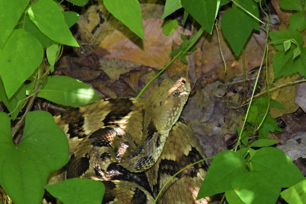
Believe it or not, their journey was officially blessed at the very start with an encounter with Bull Run Mountains very own native snake mascot, the timber rattlesnake!

VOF Preserve Staff participate in Reserva: The Youth Land Trust 5k Fundraiser
Timber rattlesnake. Photo by Michael Carr
VOF Preserve Staff participate in Reserva: The Youth Land Trust 5k Fundraiser
Timber rattlesnake. Photo by Michael Carr.

In addition to that fitting and powerful start, Team Andean Ssssnaileater’s adventure lasted 4 hours, 48 minutes and 48 seconds. During this time, they traversed over 1,915ft of cumulative gain in elevation, with an average pace was 0.8mph (aka, a naturalist’s pace!) and encountered over 47 species of organisms (some have yet to have been identified)!

Next year VOF plans to partner with Reserva: Youth Land Trust and offer public Mini-Bioblitz style hikes around our 5k length green loop, where we will compare and contrast our native species with those found in the Ecuadorian cloud forest’s that Reserva: Youth Land Trust is working to protect!

So, please do stay tuned for your opportunity to #runfortherainforest next year, and in the meantime please visit their website below for more information about their amazing youth-based conservation work!

https://reservaylt.org/

Species encountered during BioBlitz route:

Check the photo gallery below to see examples of some of Team Andean Ssssnaileater’s observations.

Animals:

Timber rattlesnake (Crotalus horridus)

Box turtle (Terrapene Carolina)

Pileated woodpecker (Dryocopus pileatus)

Worm eating warbler (Helmitheros vermivorum)

Wood thrush (Hylocichla mustelina)

Louisiana waterthrush (Parkesia motacilla)

Eastern phoebe (Sayornis phoebe)

Ruby-throated hummingbird (Archilochus colubris)

White-tailed deer (Odocoileus virginianus)

Fishing spider (Dolomedes sp.)

Wooly adelphid (Eriosoma lanigerum)

Luna moth (Actias luna)

Yellow-collared scape moth (Cisseps fulvicollis)

Golden-backed snipe fly (Chrysopilus thoracicus)

Cardinal jumping spider (Phidippus cardinalis)

A yet to be identified species of large, unusual fly (Order Diptera – collected to be further identified, studied, and recorded for our area)

Plants:

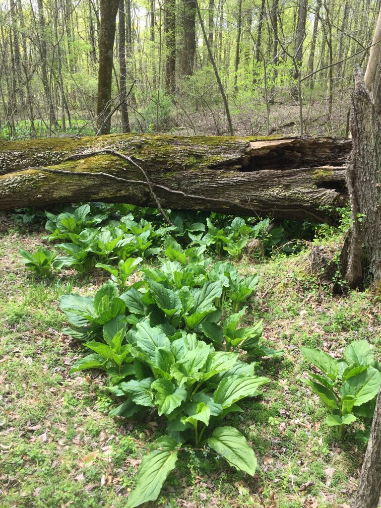
Skunk cabbage (Symplocarpus foetidus)

False hellebore (Veratrum viride)

Showy orchid (Galearis spectabilis)

Bloodroot (Sanguinaria canadensis)

Solomon’s seal (Polygonatum biflorum)

False solomon’s seal (Maianthemum racemosum)

Nodding lady’s tresses orchid (Spiranthes cernua)

Downy rattlesnake plaintain (Goodyera pubescens)

Striped wintergreen (Chimaphila maculate)

Violet wood sorrel (Oxalis violacea)

Upright yellow wood sorrel (Oxalis stricta)

Wild comfrey (Cynoglossum virginianum)

Blue-eyed star grass (Sisyrinchium angustifolium)

Roundleaf greenbriar (Smilax rotundifolia)

Blackberry (Rubus ursinus)

Maidenhair fern (Adiantum pedatum)

Broad beech fern (Phegopteris hexagonoptera)

Lady fern (Athyrium filix-femina)

Northern oak fern (Gymnocarpium dryopteris)

Cinnamon fern (Osmundastrum cinnamomeum)

Christmas fern (Polystichum acrostichoides)

American witch-hazel (Hamamelis virginiana)

Mountain laurel (Kalmia latifolia)

Red oak (Quercus rubra)

White oak (Quercus alba)

Tulip poplar (Liriodendron tulipifera)

Chestnut oak (Quercus prinus)

American beech (Fagus grandifolia)

American hornbeam, or muscle wood (Carpinus caroliniana)

Fungi:

Chicken of the woods (Laetiporus sulphureus)

White cup fungus (Peziza sp.)

VOF announces $1.26 million for 29 open-space projects

VOF announces $1.26 million for 29 open-space projects
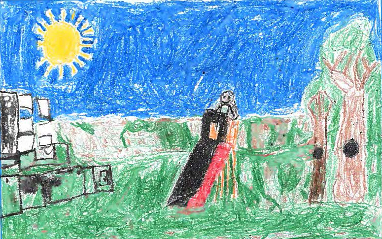
Elementary students in Lawrenceville, Brunswick County, shared their visions for a new park, which is one of 29 projects awarded grants by VOF in June 2021.

The Virginia Outdoors Foundation (VOF) today announced $1,262,831 in grants for projects that increase access to public open space in 25 counties and cities.

The 29 grants were awarded from VOF’s Preservation Trust Fund and Get Outdoors grant programs. Preservation Trust Fund projects require land to be protected for public benefit through VOF or a local government under Virginia’s Open Space Land Act. Get Outdoors grants focus on communities that have been inadequately served, overlooked, or harmed by unfair zoning, housing, and land-use practices or other systemic discrimination.

To learn more about VOF’s grant programs, visit https://www.vof.org/protect/grants/.

Grant Recipient Summaries

Preservation Trust Fund

Grantee: Amherst County
Locality: Amherst County
Amount: $59,665
Project: Riveredge Trail Extension and Lee Park Project
Description: To acquire up to five acres along the James River to build the final 2,000-ft trail link between Riveredge Park and the James River Heritage Trail (JRHT) and to provide a public access point to the James River adjacent to the Fertilizer Road Trailhead.

Grantee: Belmead on the James, Inc.
Locality: Powhatan County
Amount: $150,000
Project: Drexel-Morrell Center
Description: To protect the 56-acre Rosemont property and create the Drexel-Morrell Center for environmental justice, which will tell the story of African American life impacted by the Drexel and Morrell schools.

Grantee: Blue Ridge Discovery Center
Locality: Smyth County
Amount: $150,000
Project: Blue Ridge Discovery Center Restoration of Historic Konnarock Training School
Description: To restore the historic Konnarock Training School, at the foot of Whitetop Mountain, to become the Blue Ridge Discovery Center for community-based outdoor education and recreation in Southwest Virginia.

Grantee: Capital Region Land Conservancy
Locality: City of Richmond
Amount: $150,000
Project: River City Middle School Greenway
Description: To acquire an 18-acre parcel adjacent to River City Middle School to provide outdoor education and recreation opportunities, and to serve as a trail connector of the James River Park System to Pocahontas State Park.

Grantee: Mitchell YOUniversity
Locality: Nelson County
Amount: $100,000
Project: Shipman School
Description: To protect a former school for African American students known as the “Shipman Colored School,” which will be renovated with assistance from Preservation Virginia as a cultural community center with a focus on the arts, learning and entrepreneurship.

Grantee: Roanoke County
Locality: Roanoke County
Amount: $100,000
Project: Roanoke River Greenway and Blueway at Niagara Dam, Joining Explore Park
Description: To acquire 47-acres of forested land that will provide connectivity among Roanoke River Greenway, Roanoke River Blueway, Explore Park, and the Blue Ridge Parkway, as well as new recreational and educational opportunities for the community.

Grantee: Thomas Jefferson Foundation, Inc.
Locality: Albemarle County
Amount: $30,000
Project: Shadwell Trail; Old Mills Trail extension; Three Notch’ed Trail
Description: To acquire a parcel along the Rivanna River to dedicate a right of way access to Albemarle County, providing the final piece of land needed for the planned extension of the Rivanna River Greenway Trail, including public access to 3.2 miles of riverfront.

Grantee: Tidewater Trails Alliance
Locality: Surry County
Amount: $86,635
Project: The Birthplace of America Trail— Surry County Link
Description: To acquire an easement to create a 4-mile connection of the Birthplace of America Trail in Surry County, which will provide a multi-use trail, separated from cars, to an underserved population in the Hampton Roads region.

Grantee: Town of Blacksburg
Locality: Montgomery County
Amount: $85,000
Project: Meadowbrook Greenway
Description: To acquire a 3/4-mile right-of-way trail easement while funding design and engineering work for a greenway connecting to an existing trail network for pedestrians, cyclists, and horseback riders to the previously VOF-funded Brush Mountain properties.

Get Outdoors

Grantee: Agee Miller Mayo Dungy Pine Grove Project
Locality: Cumberland County
Amount: $24,465
Project: Pine Grove Park, Phase One
Description: This project will establish a multi-purpose, safe space on the grounds of the Rosenwald Pine Grove School and adjacent land. The future Pine Grove Park will contain cultural interpretive space, nature trails, and green space for community gatherings, and will extend the original mission of Pine Grove School by providing community-based experiential learning that incorporates nature, science, culture and the arts.

Grantee: Brunswick County Industrial Development Authority
Locality: Brunswick County
Amount: $25,000
Project: Trail Gateway Project
Description: This project will fund the purchase of a picnic shelter and playground equipment to be located along the Lawrenceville trail head segment of the Tobacco Heritage Trail, a path to outdoor recreation and relaxation.

Grantee: Charles City County
Locality: Charles City County
Amount: $25,000
Project: Harrison Park Walking Trail
Description: This project will provide county residents and visitors with a fully accessible looped trail at Harrison Park, a 19-acre community athletic park. The improvements include refinishing an existing partial asphalt trail, extending and existing trail and complying with ADA accessibility.

Grantee: City of Radford
Locality: City of Radford
Amount: $24,498.41
Project: James Oakley Fields Playground Improvements
Description: This project will renovate a neighborhood ballfield and install inclusive playground equipment at the park.

Grantee: College Park Elementary School
Locality: City of Virginia Beach
Amount: $10,020
Project: Outdoor Classroom for Early Learners
Description: This project will transform a barren, fenced-in blacktop into an outdoor classroom for students in kindergarten and 1st grade. This space will engage learners in critical thinking, promote creativity, develop problem-solving skills, and provide hands-on learning with outdoor tables and gardens.

Grantee: Community Unity in Action / Kinfolk Community
Locality: City of Richmond
Amount: $18,648
Project: Growing Food Justice in Richmond East End
Description: The Food Justice Corridor is a plan developed to transform food desert neighborhoods in East End Richmond, resulting in an empowered community through a holistic approach that provides marginalized people of color access to education and training around the benefits of urban farming as a pathway to healthy living and as an economic survival model.

Grantee: Dickenson County Board of Supervisors
Locality: Dickenson County
Amount: $10,450
Project: Bear Pen Recreation Park Project
Description: Park improvements will include a gazebo for educational field trips for kids and musicians to perform along The Crooked Road Music Trail, as well as opening access to the Pound River for recreation by having a kayak launch ramp.

Grantee: Essex County
Locality: Essex County
Amount: $25,000
Project: Rotary Poorhouse Park Trails
Description: This project will reconstruct trails destroyed in 2016 by a tornado. The county will also redo signage, perform road work and install a main gate.

Grantee: Fairfax NAACP
Locality: Fairfax County
Amount: $25,000
Project: Connecting the Community with Nature
Description: Fairfax NAACP, Calleva River School and United Community have partnered to provide an environmental education camp to diverse and underserved youth, ages 9 to 15, in Fairfax County. The 5-day day camp will run for four weeks in August with different students each week, where they will engage in a safe, green space, and participate in activities including rafting, stand up paddle-boarding and rock climbing.

Grantee: Franklin County Parks and Recreation
Locality: Franklin County
Amount: $5,000
Project: Capacity Building by Bicycle
Description: This project will support the Benjamin Franklin Middle School Mountain Bike Club to fund the purchase of 5 to 7 bicycles to provide equitable access to middle school students who would otherwise be unable to participate.

Grantee: Friends of Southwest Virginia
Locality: Tazewell County
Amount: $15,000
Project: Tazewell Area Trails East River Mountain/Big Dome Rock
Description: This grant will assist with the construction of two trail-running routes, kiosks at trailhead parking areas, and a “big tree” inventory of the East River Mountain site.

Grantee: Happily Natural Day
Locality: Richmond City
Amount: $25,000
Project: Community Gathering Space at Sankofa Community Orchard
Description: The Sankofa Community Orchard serves as a public urban green space with 80 fruit trees and fruiting shrubs in the Southside of Richmond Virginia. This green space serves a multi-faceted approach to increasing Richmond’s urban tree canopy while addressing food insecurity through volunteer workdays and educational workshops.

Grantee: Holston High School
Locality: Washington County
Amount: $4,800
Project: Holston High School Bouldering Project
Description: This project will help construct a bouldering wall at Holston High School, providing a year-round training facility and a positive after-school environment for students.

Grantee: Mendota Trail Conservancy
Locality: City of Bristol
Amount: $24,000
Project: Bristol Trailhead Development
Description: The Mendota Trail Conservancy is transforming a 2.5-acre parcel at its trailhead in Bristol into a park-like space, which will be the community’s primary access point for the 12.5-mile recreational trail.

Grantee: Richmond Cycling Corps
Locality: Henrico County
Amount: $5,000
Project: MTB Program
Description: This project will fund a youth biking program for residents of Richmond’s East End through a variety of skill-level programs.

Grantee: Rivanna Trails Foundation
Locality: City of Charlottesville
Amount: $24,650
Project: Fifeville Trail Restoration Project
Description: This project will connect an income-qualified apartment complex and surrounding neighborhoods to Tonsler Park with a natural-surface trail through a use-agreement with a local landowner.

Grantee: Shenandoah Valley Bicycle Coalition
Locality: City of Waynesboro
Amount: $12,000
Project: Sunset Park Community-Centric Trails Planning and Stewardship
Description: This project will design and develop the first natural surface trails in the City of Waynesboro on a portion of the forthcoming Sunset Park, which was once a landfill.

Grantee: Town of Alberta
Locality: Brunswick County
Amount: $18,500
Project: Tobacco Heritage Trail Danieltown Extension
Description: This project will assist with the final design and engineering of a 5.2-mile extension of the Tobacco Heritage Trail to an area in the county known as Danieltown.

Grantee: Town of South Boston
Locality: Halifax County
Amount: $25,000
Project: South Boston Sinai Park Project
Description: This project will convert a 4.57-acre parcel on Westside Drive into a town park with picnic tables, a covered shelter, restrooms, and playground equipment.

Grantee: Virginia Capital Trail Foundation
Locality: Henrico County
Amount: $4,500
Project: Multi-Lingual Website and Trail Materials
Description: This project will create multilingual materials and provide a Spanish-language website to create a more inclusive environment and better serve Hispanic communities using the Virginia Capital Trail.
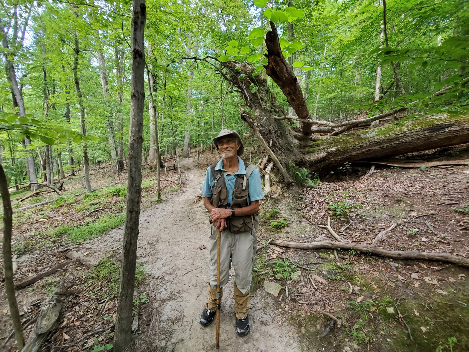
Hull Springs, Westmoreland County

Hull Springs, Westmoreland County
Hull Springs' approximately 8,400 feet of tidal shoreline on Aimes and Glebe Creeks give students the opportunity to see conservation at work.

Hull Springs, a VOF-protected 662-acre outdoor classroom and research field station in Westmoreland County, is usually buzzing with activity. Mary Farley Ames Lee, the alumna who bequeathed the property to the Longwood University Foundation in 1999, wouldn’t have had it any other way. True to her vision, the site hosts students from both the Prince Edward County-based university and Westmoreland County schools, helping them learn about native plants, ecological communities, and living shorelines.

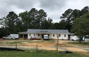
In 2020, activity at Hull Springs shifted from educational activities to the construction of a new research lab. The lab is slated for completion in June of 2021. Photo courtesy of Hill Springs Foundation.

Last year, the pandemic brought much of that activity to a halt, forcing Hull Springs to pause its in-person programming. But don’t worry, says Hull Springs’ executive director Sherry Swinson, “We’re coming back, bigger and better than before.”

The foundation made the most of the 2020 pause by focusing its energy on building a new state-of-the-art research lab. The $1.2-million facility will enhance how the site serves Longwood University faculty and student research, as well as allow for the expansion of existing partnerships with the Virginia Institute of Marine Science, Westmoreland County Public Schools and others.

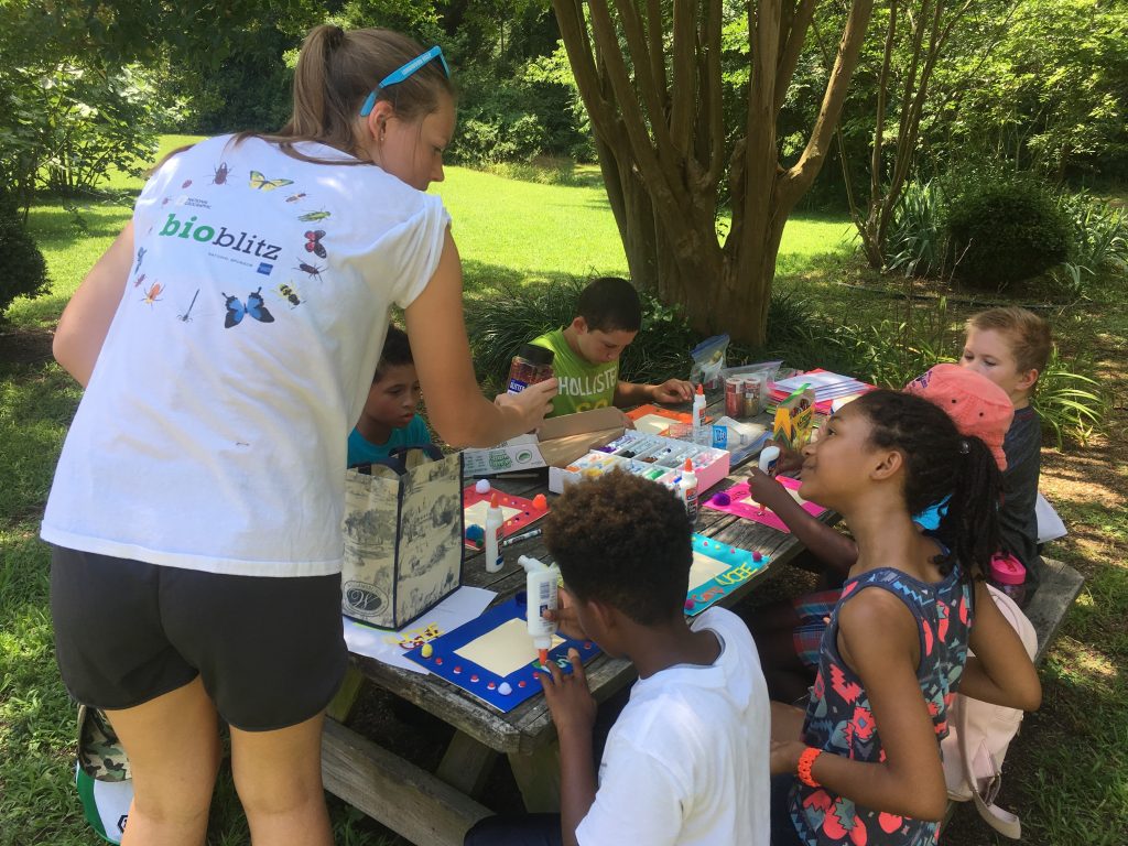
Students from Westmoreland County public schools participate in activities led by their teachers and Longwood students. Photo courtesy of Hull Springs Foundation.

One program to benefit is the Longwood University Camp for Environmental Exploration (LUCEE), which serves local school kids through summer camps. Camps will resume in the summer of 2022, and the kids will use the lab for many of the camp activities, Swinson says. “Campers will have access to microscopes, see up close how a rain harvesting system works, and hopefully hear the latest reports from ongoing research projects being conducted at the site by Longwood faculty and students.”

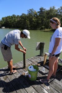
Students from Longwood conduct routine cleaning and calibration of the LEO sensors on the property. Photo credit: Dina Leech

Another program that is ready to take advantage of the on-site lab is the Longwood Environmental Observatory (LEO). The “observatory” is a network of environmental sensors that faculty and students have deployed across the site to monitor local weather conditions, water quality, water temperature and water oxygen levels. These sensor readings supplement information provided by the water samples biology professor Dina Leech and her students collect by hand. Leech, who started monitoring Hull Spring’s creeks with her students in 2014, is excited to start using the new lab once it is completed in June. “Before, my students and I would have to collect our samples, then drive three hours to get them back to the [Farmville] campus lab to process,” she says. “The new lab is going to make our lives so much easier.”

Leech adds that the LEO datasets have also provided opportunities for collaboration across departments. Faculty in computer science and math have been using them to teach how to quality-check large data sets and make them searchable. Communications students are working on marketing the data and making it publicly accessible. “Ideally, we’d like a public website that people can access anytime,” Leech says. “We hope to get the public interested in science and how they might be involved in solutions to the problems we’re facing now.”

As LUCEE, LEO, and other programs on the property ramp back up, ideas for taking advantage of the new lab facilities are percolating. “We just put a request out to our faculty to submit research proposals for the fall,” says Leech. Green construction plans for a cabin-like dormitory where Longwood students can spend the night during research trips are also in the works. As Swinson notes, “There is so much potential up there, and the new lab will help us take advantage of all the property has to offer.”

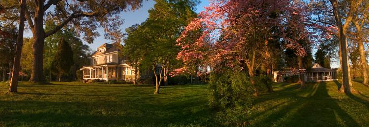
The “Big House” on the property is available for events and overnight stays. Photo courtesy of Hull Springs Foundation.

For those not affiliated with the university, the “Big House” at Hull Springs is available for events and overnight stays. Groups can schedule plant and bird walks by writing Sherry Swinson at swinsonsd@longwood.edu.

The Preserve’s Spotlight Species: Mountain Laurel

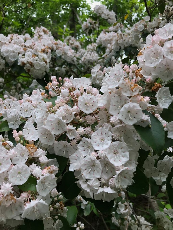
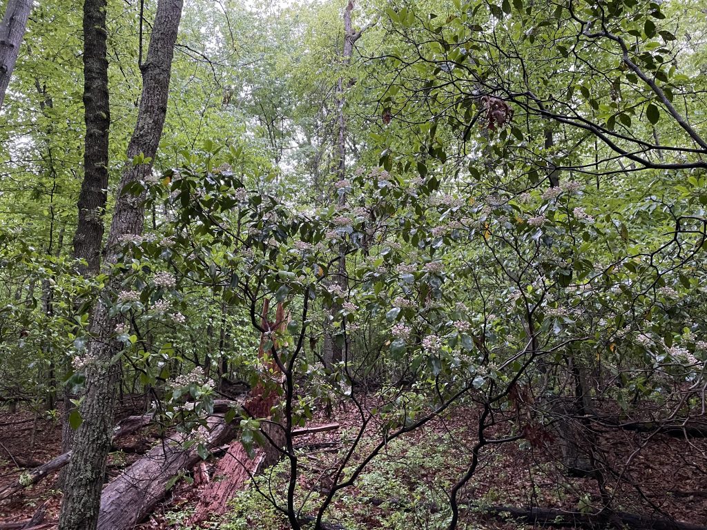
For this week’s #sciencesaturday we are highlighting a species that has just started to bloom on the Preserve: Mountain laurel (Kalmia latifolia). Mountain laurel is one of my favorite plant species in Virginia for a number of reasons. It has a whimsical growth structure of crooked and swooping branches, forming a dense rounded crown of glossy, dark-green leaves. Its bark is distinctive, made up of long, thin strips of reddish-brown paper-like bark all layered on top of each other. Hiking on a trail that winds through mountain laurel seems to turn into almost a magical space; cool shadows held into place by its tangled branches and sweet summer scents wafting from its flowers.

The Preserve's Spotlight Species: Mountain Laurel
Mountain laurel shrub off of the Fern Hollow Loop - Photo by Summers Cleary

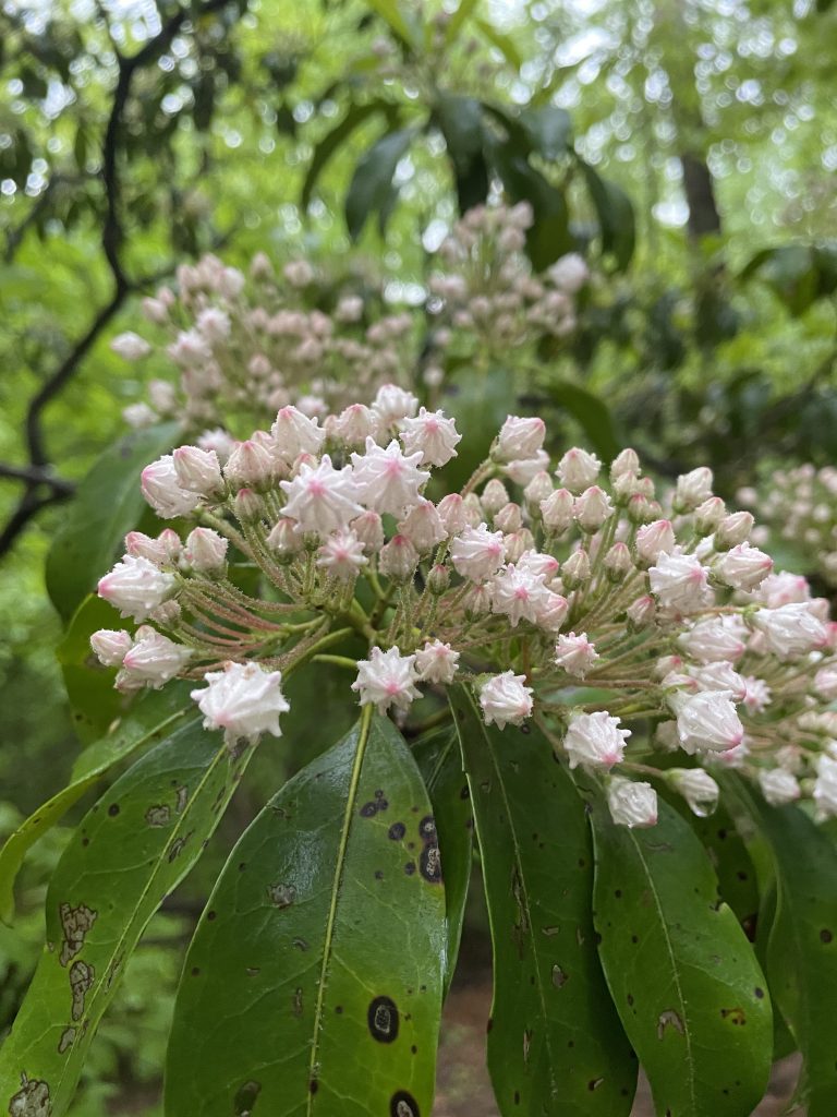
While you may be familiar with its evergreen leaves, the flowers that have just begun to bloom are well worth taking a hike on the Preserve’s Fern Hollow Loop to see. The buds are conical, fluted, and range from white to deep pink in color. When the buds open, the petals (also known as corollas, meaning all the petals of a flower), look like geometric, five-sided parasols.

The Preserve's Spotlight Species: Mountain Laurel
Mountain laurel on the cusp of blooming - Photo by Summers Cleary
The Preserve's Spotlight Species: Mountain Laurel
Prolific blooms - Photo by Summers Cleary
The Preserve's Spotlight Species: Mountain Laurel
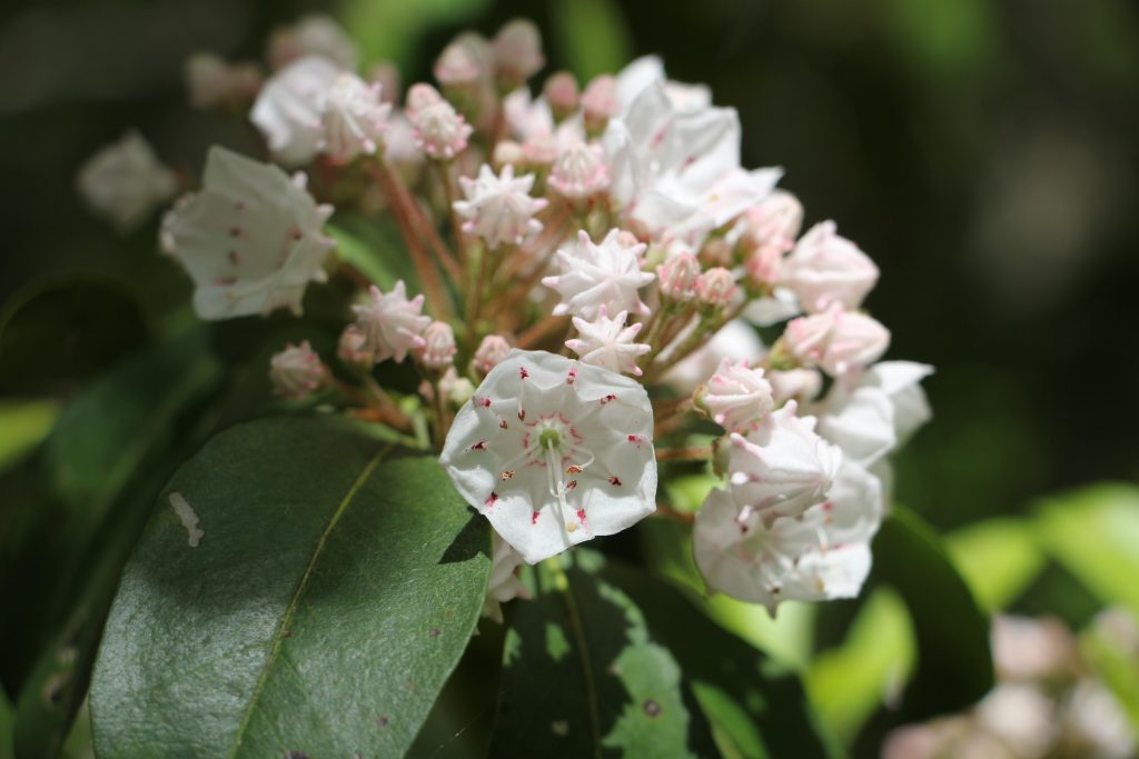
Intricate, geometric mountain laurel blooms. Some of the anthers have been triggered in this front bloom - Photo by Becky Conway

Before the buds open, they come in curious club shapes, with knobs surrounding the bud. As the flowers open, the function of these knobs become apparent. The anthers (or, pollen carrying part of the flower) are nestled and held in each of these knobs. This is a unique strategy in pollination, as many flower structures have their anthers completely exposed, able to sprinkle pollen at the slightest touch of any pollinating visitor.

Mountain laurel, however, keeps its anthers tucked away, thus protecting pollen from rain and wind. When a pollinator visits the flowers (mountain laurel is predominantly pollinated by bumblebees) in search of nectar, the weight acts as trigger, causing the stem of the anther to spring out of it’s pocket and gently hit the pollinator, dusting it with pollen.

Check out this video from the Royal Botanic Garden Edinburgh, for a depiction of the pollination process

As you hike through the Preserve on your next visit, see if you can spot which flowers have been pollinated on our mountain laurel shrubs.

Town Square Development, City of Buena Vista

Town Square Development, City of Buena Vista
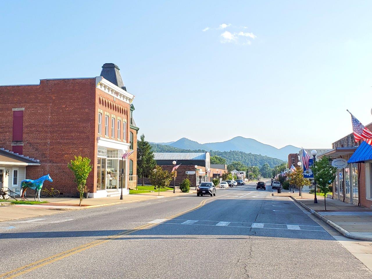
Downtown Buena Vista's quaint storefronts and gorgeous views make it ripe for revitalization.

When a developer bought more than a dozen properties in downtown Buena Vista in 2017, city leaders were hopeful that revitalization of the once vibrant town center would soon follow. Then came 2020, the pandemic shifted economic prospects for many, and the developer needed to liquidate. Among the properties scheduled to be sold at public auction was a 12,500-square-foot empty lot that revitalization plans had designated as the future town square.

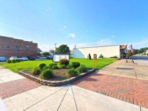
Of all the properties scheduled to be sold, that empty lot was the most important, says Kristina Ramsey, economic development and marketing coordinator for the City of Buena Vista. “It’s one of the few green spaces left downtown that could be used as a public park.”

One of the last open spaces in downtown, the lot was in danger of being developed when citizens convinced the city to find the money to buy it.

City leaders worried that any potential buyers would not share that vision for the property, but the city’s own budget shortfall meant that it couldn’t buy the property itself.

A pivotal city council meeting that September, however, changed everything. At the meeting, the citizens of Buena Vista stepped up and voiced their desire for the city to find a way to buy the lot so that the town square could be realized. Says Ramsey, “We were pleased and surprised. They were ahead of us in expressing their desire for the city to purchase that space.”

That’s when “city staff went into high gear,” adds Tom Roberts, Buena Vista’s director of community and economic development. “We began to investigate grant opportunities that could cover the cost.”

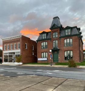
The historic city hall is now the town library, and another draw for downtown activity.

Their work paid off; they received a $78,000 grant from the Virginia Outdoors Foundation’s Preservation Trust Fund to buy the property. Plans include a pavilion for hosting a weekly farmers market, block parties, and festivals, with a lawn for picnics and outdoor films and performances, and an information kiosk where visitors can learn about the many outdoor recreational opportunities nearby.

The town square will also serve educational purposes, as an extension of the Buena Vista public school system’s outdoor classroom and an opportunity for students from Southern Virginia University to design outdoor programming—just seven blocks from their campus.

The city has already begun engaging the community in the design and construction of the square and pavilion, designating a Town Square committee made up of private citizens. Several have come forward with offers to donate materials and labor to help construct the pavilion and landscape the space.

“Now that we’ve been awarded this grant, the committee is anxious to get started,” says Roberts. “If you go back 50 years, downtown was a county shopping hub. The town square will catalyze development and make it a vibrant gathering spot again.”

The Preserve’s Spring Spotlight Species: Box Turtle

The Preserve's Spring Spotlight Species: Box Turtle
Image: Becky Conway

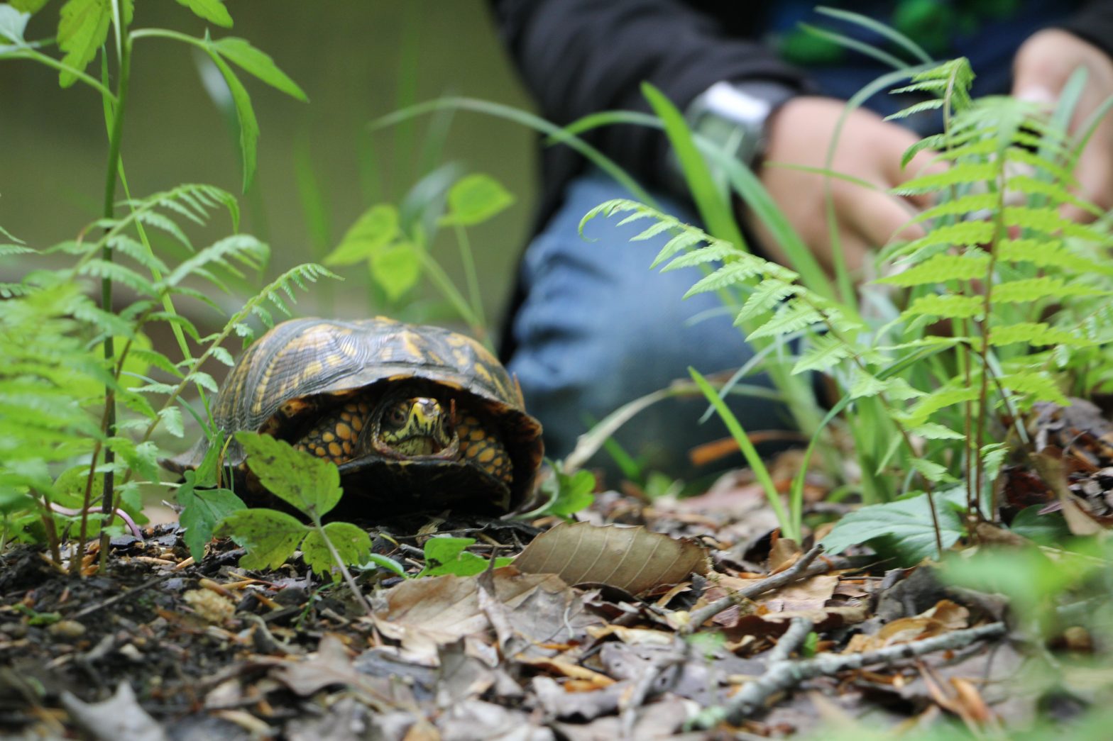
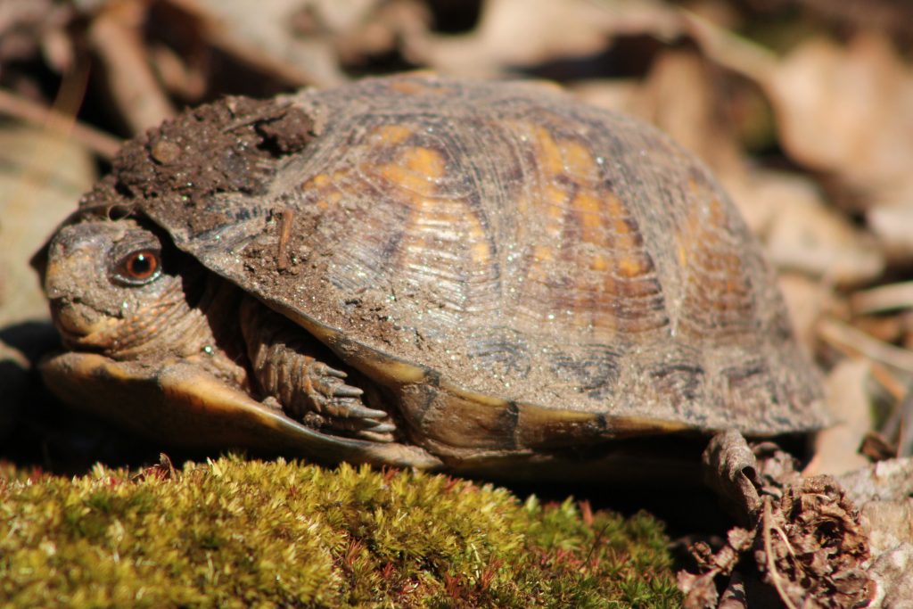
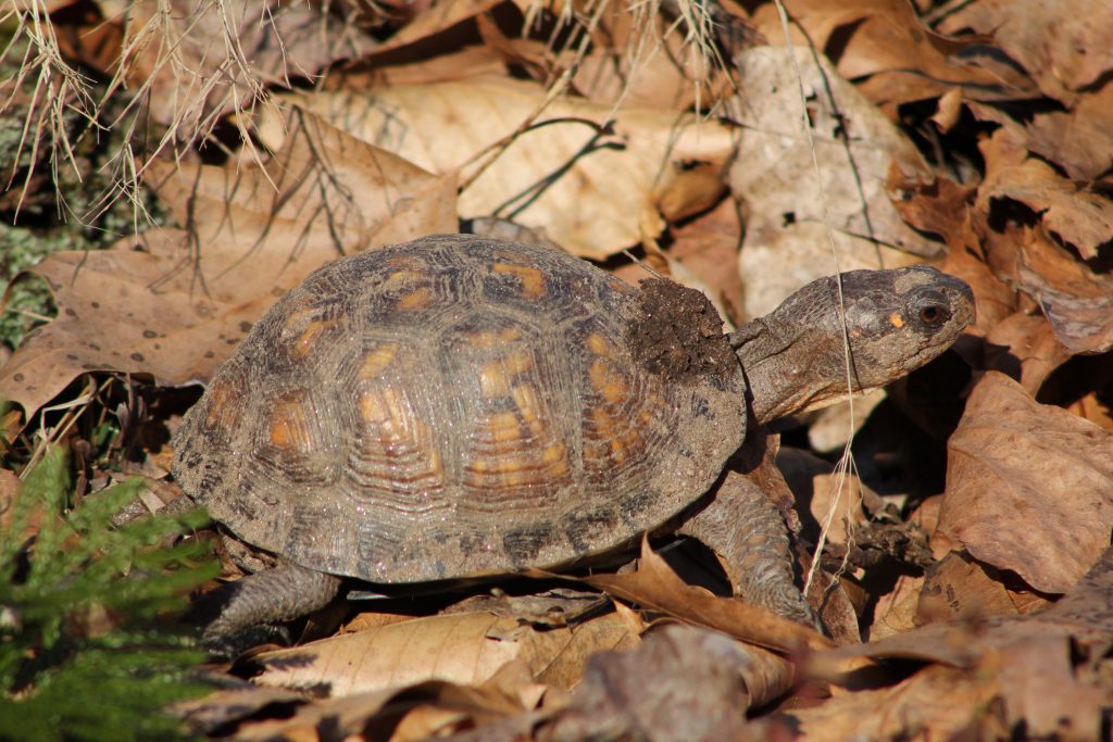
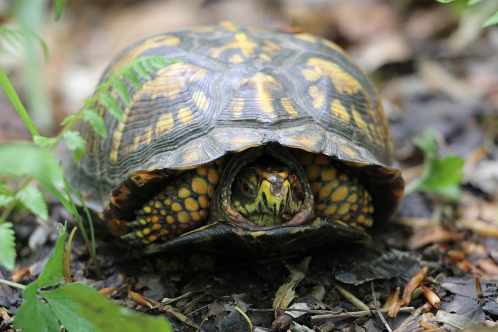
This #sciencesaturday recognizes one of my favorite Preserve residents, the Eastern Box Turtle (Terrapene carolina). These reptiles are most easily identified by their high domed upper shell (called a carapace), four clawed feet, and ability to hide entirely in their shell. Turtle shells are made out of bone and cartilage, and there are nerve endings in it so they can feel when anything touches them! The bottom shell, or plastron, has a hinge, which develops when the juveniles are four to five years old. It allows the turtles to tuck their head, limbs, and tail into the shell when startled or threatened, and close the front just like a box. Once safely hidden inside, the shell is extremely difficult to pry open, and the box turtle can wait out any danger.
The Preserve's Spring Spotlight Species: Box Turtle
Image: Summers Cleary

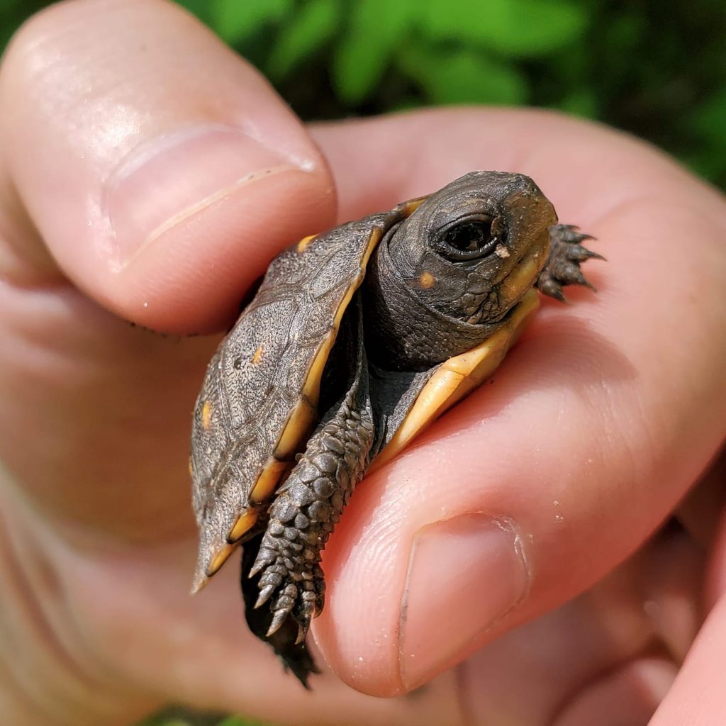
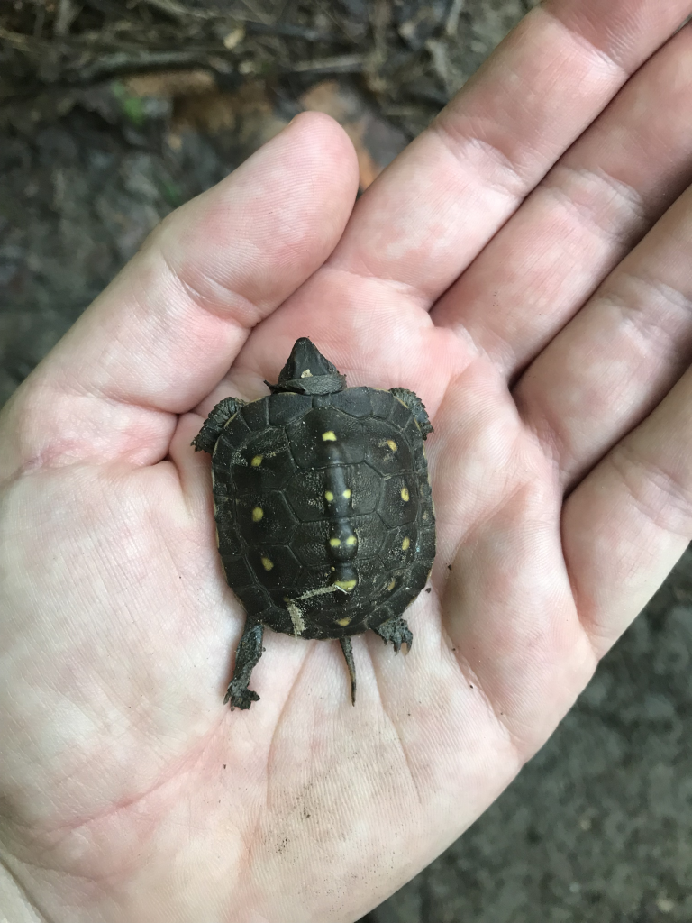
Female box turtles lay three to six eggs during June and July, using their back legs to dig a hole. They also tend to pick previously disturbed areas, such as the edges of our extensive trail system at the Preserve! The female then recovers the nest with dirt and leaves the eggs to hatch by themselves in two to three months. The temperature of the nests determines the hatchling sex, as warmer ones usually produce females, and cooler nests produce males. Young box turtles, so small and mostly brown, camouflage well with the forest floor, and are easily missed on a hike. Adults can live 30 to 40+ years in the wild but some can live over 100 years!

The Preserve's Spring Spotlight Species: Box Turtle
Image: Joe Villari

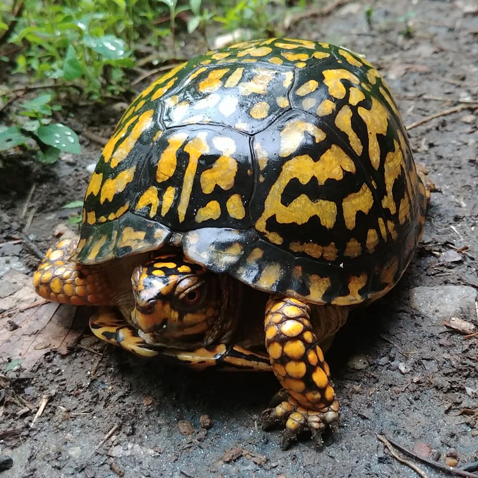
Male box turtles are often much more colorful than females. They also have red/orange eyes, while the females have brownish/yellow ones. When they are first born, all box turtles have brown eyes, but they will begin to change when they are five years old. Another identifying characteristic is the male plastron is concave, while a female’s plastron is flat. 

The Preserve's Spring Spotlight Species: Box Turtle
Image: Becky Conway

As a diurnal species, box turtles are more active exploring and feeding during the day. They eat a smorgasbord of plants and small invertebrates including worms, slugs, snails, bugs, berries, and leaves. They have triangular upper lips (called beaks – just like birds!) instead of teeth to crunch through their snacks. They also eat mushrooms, even poisonous ones. Turtles absorbs those toxins and can make anything that tries to eat it sick. That is why it is important to remember that if you are ever stranded in the wild, a box turtle actually may not be a safe source of food. 

During hot days or seasons, box turtles seek out cooler areas, like the Bull Run Mountain springs and seepages, burrowing in the mud or under logs and leaf litter. These cold blooded reptiles will spend winter buried beneath the frost line, hibernating until the warm spring weather returns. Adult box turtles tend to have a home range they are most familiar with, and if they are relocated, they try to return to their known area. If you see any on the trails, take a picture of them and upload it to our Bull Run Mountains iNaturalist Project!

The Preserve's Spring Spotlight Species: Box Turtle
Image: Becky Conway

Box turtles are not listed as endangered or a species at risk, however, they are still threatened from habitat loss and fragmentation. Road crossings are another danger zone for these critters that look like rocks with legs. Although their hard shell is made up of plates of bone, it can still be damaged and even bleed if they’ve been run over or chewed on by a dog. If you see a boxie in the road, make sure to move them in the direction they were already facing. Make sure to wash your hands after the encounter, as many turtles carry bacteria on their outer skin and shells, like Salmonella, that can make people sick.

The Preserve's Spring Spotlight Species: Box Turtle
Image: Summers Cleary

Box turtles are found throughout the eastern United States, however, they are sometimes living outside of the east coast. This can happen because turtles are very popular pets, and are threatened by poachers who illegally take box turtles out of the wild to breed for the pet trade. Such a pet is an extended commitment, considering how long they live. Some owners that do not want to take care of their pet turtles anymore, if they outgrow their small tank or the owners are moving, release the discarded pet to the wild. For a domestic turtle unused to fending for itself, it is extremely difficult for it to survive in a different environment. The better alternative is to drop them off at a local animal shelter/veterinarian, or listing them for adoption online such as at the Mid-Atlantic Turtle & Tortoise Society.

Introduction to Archaeological Survey in the Preserve

Introduction to Archaeological Survey in the Preserve

I interrupt my regularly scheduled spring spotlight species post to bring you a new lens of #sciencesaturday. On April 17th, I had the incredible experience to shadow an archaeology survey in a new area of the Preserve. Away from the easily accessible and marked trails, this study was searching for anything that looked like it was changed by humans within the Preserve boundary. As someone comfortable in environmental science and natural history, this was a unique opportunity to go outside my area of expertise and discover a new field. Below, I will take you with me on the day’s adventure and provide a glimpse into a different type of on-going scientific research from the perspective of a novice within the Bull Run Mountains.

Introduction to Archaeological Survey in the Preserve

The morning started off brisk and bright. Once everyone arrived and introductions passed, we headed into the Preserve, guided by Professional Archaeologist,  Patrick O’Neill. O’Neill is providing professional level services as an archaeological volunteer for the study of the cultural and historic Preserve landscape. He is also the President of the Northern Virginia Chapter of the Archaeological Society of Virginia (ASV) and Vice President of the state ASV. Most of the participants of the survey are members of the Northern Va. Chapter.

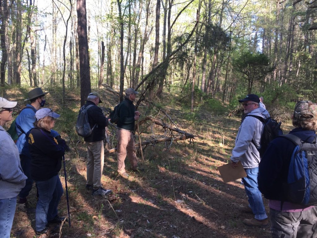
I appreciated how Patrick emphasized this phase of the survey was purely pedestrian. He intentionally stressed that although we would walk around the woods to investigate anything unnatural, we should still be respectful of the other wildlife and plants. Because we were within a Preserve, he did not want to rush to a slightly more invasive shovel testIf we didn’t find any evidence of historic activity, such as a cemetery or a foundation, then there would be “no need to do a later 100% inventory because we want to leave nature in place”.

Introduction to Archaeological Survey in the Preserve
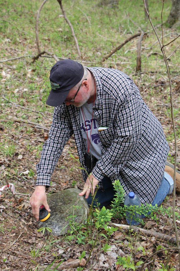
Patrick looking at cemetery headstone using shadowbox method with a jacket and high powered light


"Good experience for people to have looking in the woods... anything out there that's not natural, let's have a look at it" -Patrick O'Neill: Vice President, ASV; Volunteer Archaeologist, VOF

Introduction to Archaeological Survey in the Preserve

Patrick had several teaching moments along the hike in the forest, where he stopped and explained to the group how to use visual cues to infer a possible story to interpret the landscape. This could be the presence of certain types of trees or a ridge that may look natural but actually came from the construction of highway 66. This is one reason he is confident there is no chance of any prehistoric significance in one spot, and supports using the area as a future parking lot and new trailhead for the Preserve. Based on his archival research looking at aerial photographs and maps from previous surveyors, Patrick knows, “there is so much potential out here, but we should be able to see something if it’s there. We want to see what’s not there and what is.”  

Introduction to Archaeological Survey in the Preserve

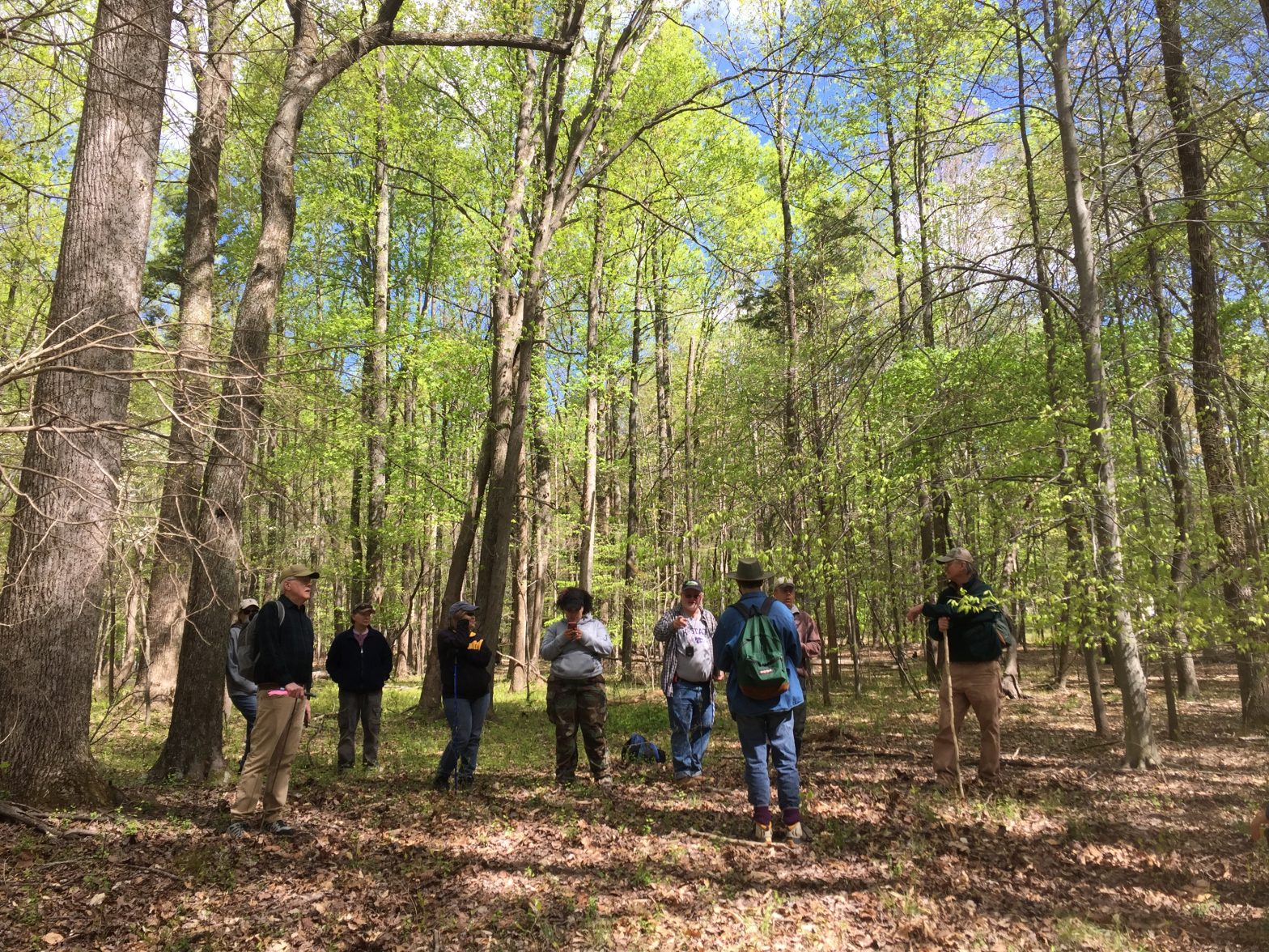
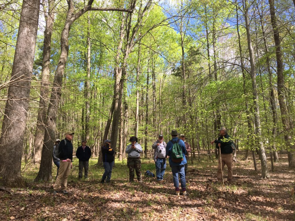
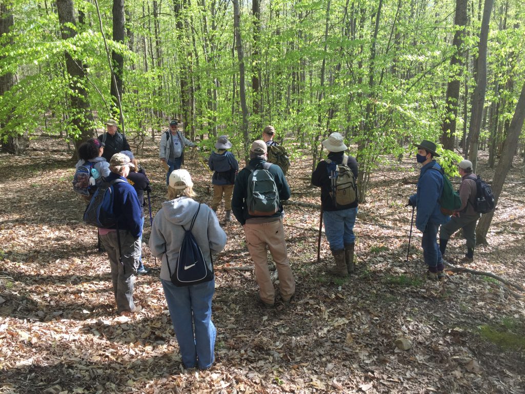
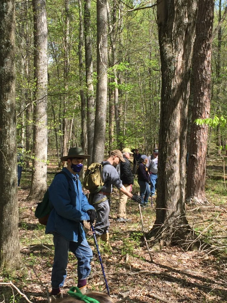
Once we reached the area to survey, I learned how we planned to walk the field using transects. From his predesignated location, we lined up at the blue and white striped marking flags Patrick used during his previous survey (you always want to use distinctive flagging colors to know your information apart from anyone else who is doing research or investigating within the same area).  He spaced us out about 15 feet apart with one person tasked to follow his previous transect flagging and everyone oriented alongside them. Then we were faced with an impossible task: try to walk in a straight line through the woods

Introduction to Archaeological Survey in the Preserve
Walking a transect in a straight line
Introduction to Archaeological Survey in the Preserve
View from one of my routes

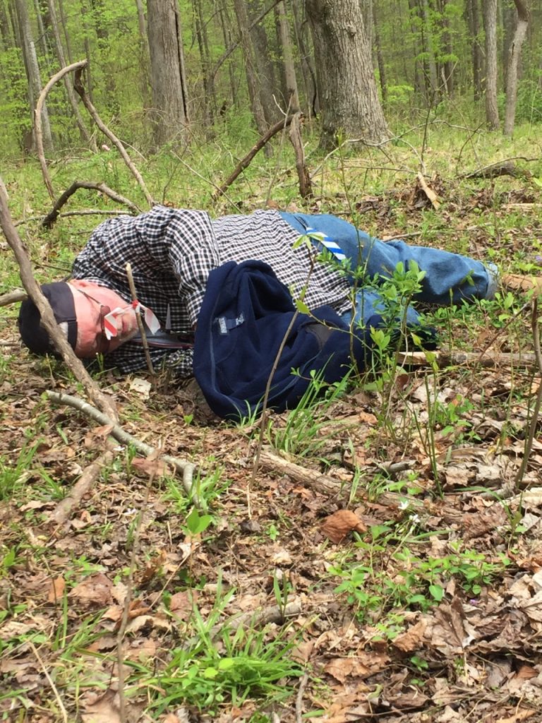
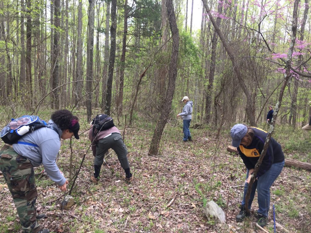
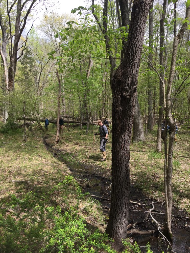
Disclaimer: this was drastically harder than I expected. Dodging fallen trees, going around thorn tangles, and hopping over swamps were just a few of the natural obstacle courses awaiting our group… all while maintaining the 15-20 feet spacing between people as best you can so hopefully all the ground was scanned. Naturally there was some drift, and we reset as necessary. Whenever someone found something that needed further investigation, we hollered for Patrick or dropped our bag to mark our spot so we could return to it after we went to see what someone else found.

Now how did we know what to look for (I’m still not totally certain)? Things like piles of rocks, old roads, trash piles, quarries, campfire rings, cellars…  or something that made you scratch your head and ask, “how did this get here?” Looking in root balls of fallen trees was one area that was easily distracting, but Patrick was quick to keep us on track if we weren’t seeing something obvious within a few seconds of scanning. He said we did not have to be as exact at this level of the survey and our main goal was to cover as much ground surface as possible at this early phase. 

Introduction to Archaeological Survey in the Preserve
This is why you wear boots and long pants
Introduction to Archaeological Survey in the Preserve
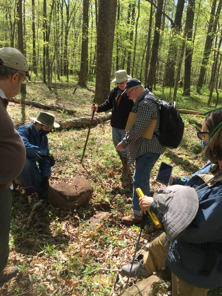
Pondering a large shaped rock

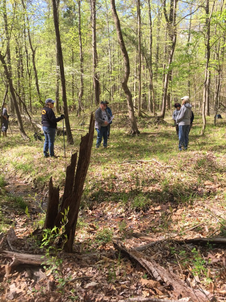
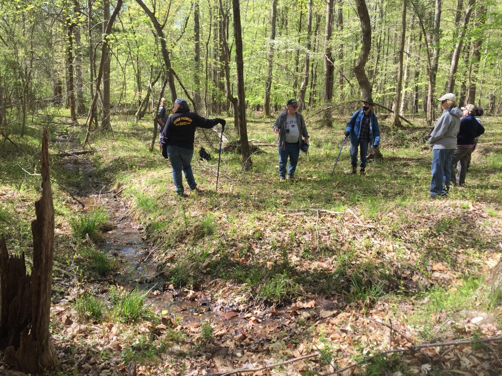
When we did identify something second-look worthy, Patrick came over and took the GPS coordinates and a picture of the find.  One area of note was a plot where water from a natural spring or seep had been intentionally diverted. The channel was in a very straight line around a triangular piece of land. This could have been a garden with an old fence, or maybe a pen to keep livestock like pigs or goats. Patrick’s take was “it has to be for water, but why?” This type of investigation can lead to fun imaginative and creative guessing, and so after pacing out and recording the dimensions of the intriguing boundary, we pushed on. 

Introduction to Archaeological Survey in the Preserve
Found something, but what is it?

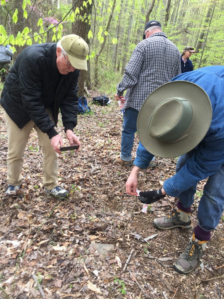
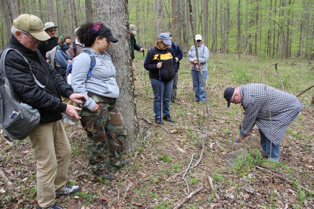
Finally we arrived at the cemetery we hoped to investigate: final resting spot of Francis Feagan (died 1801)! The first order of business was to find the graves by their head/foot stones. Patrick taught us to look for any vertical stones that were slightly stuck in the ground. If a rock was on top of the ground or easy to move with the toe of your shoe under light pressure, then it was less likely to be a marker. Since we did not have pin flags (tiny flags that would be minimally invasive), we used narrow sticks and tied flagging to the top and stuck those near the rocks. These flags were placed at every credible rock we found in the nearby vicinity, 23 in total once they were all counted. Then, after every rock was subjected to interrogation, we recorded the dimensions of the area from the farthest rock out. Each rock was then photographed from the front and side. 

Introduction to Archaeological Survey in the Preserve
Flagging all the stones
Introduction to Archaeological Survey in the Preserve

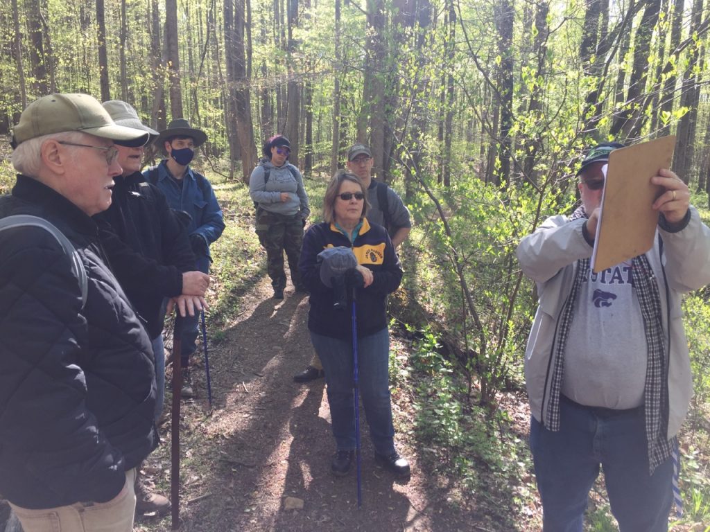
To wrap up, Patrick taught the group a new method for being as minimally invasive as possible when trying to read the faded markings on a headstone. Anything added to the surface, like sprinkling flour/sugar/salt in the grooves will increase algae growth and degrade the rock at quicker rate. Instead, Patrick poured some water on the stone. With an imaginary angelic choir singing in the background, the sun poked out and we could much more clearly see ‘F. E. 18’something. What a neat trick!

Introduction to Archaeological Survey in the Preserve
Using water to see faded inscriptions
Introduction to Archaeological Survey in the Preserve

After a day of wandering the woods, I left with more questions than answers. Who else lived back there, how did they survive, and how many ticks did they pick off their pants each day? In all seriousness, there are plenty of way more scientific and culturally relevant questions to continue to investigate. Luckily, Patrick will keep surveying the areas around the Preserve before it gets too overgrown this spring. I am very excited to see what else he finds and what happens next! 

Introduction to Archaeological Survey in the Preserve
Now the only important question left: which way is the exit?

Special thanks to all survey attendees, and a huge shout out to Patrick O’Neill for including me and making me feel welcome! All images are from Becky Conway